Dan and I were a bit late out of the gate on Monday morning, not departing Topeka until almost 11:30 a.m. We had gone to sleep the night before thinking that the primary action area would be along the Nebraska-Iowa border. However, a shortwave trough ejected out of NM early in the morning, interacting with the cutoff low over W NE.
By the time we got on I-70 and began heading west, we were already hearing reports of an explosive storm close to Hill City, KS. Our friend and colleague Mike Umscheid was chasing it, and as we watched, he began leaving a trail of tornado reports in his wake as he zigzagged north across the Nebraska border. Curses!
We eventually straggled into Smith Center, KS, just as the “children” of Mike’s storm began to race north at 40-45 mph. We crossed the KS/NE border, and proceeded north through Minden to I-80, then west. Crisp updraft towers now ringed us to the north, and low clouds obscured the bases. A tornado-warned supercell near Elm Creek was our target, but as we turned north at the Odessa, NE exit, one of the updraft towers to its east filled in the reflectivity notch on our target storm. We predicted that the storm collision would be detrimental to the western storm and beneficial to the eastern one.

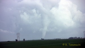
I am a bit confused about which tornado this one corresponds to in the event chronology from the NWS office in Hastings. My camcorder time stamp (which I had just set that morning) reads 4:43 – 4:46 p.m. CDT during the white tornado that appeared to be near Pleasanton, NE, but according to the NWS chronology, the Pleasanton EF-0 tornado ended around 4:40 p.m.


We elected not to pursue the storms any farther north, as we both had to return to work in Norman the following day. We enjoyed a quick steak dinner at Whiskey Creek in Grand Island, before the long haul back south.
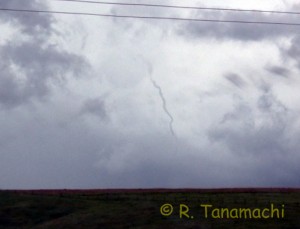
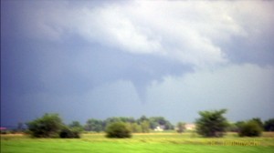
Three tornadoes in one day is certainly nothing to complain about; I only wish we could have seen at least one of them while stationary, and been able to film from tripods. Instead, we were on the move, in true chase mode, the entire time. I got zero stills, so the images in this blog post are all frame grabs. Dan ended up shooting most of the handheld video while I drove, some on his camcorder and some on mine, so I’ve split the credit with him for this video summary: