We left Norman early in the morning, thinking we might have to make it all the way to E CO to see a supercell. By the time we reached Salina, KS around noon, however, we were waffling between the E CO target, where the shear was better and the cap was weaker, and a more conditional secondary target in NE KS that would probably remain capped until later in the day, but had better moisture. Knowing that the target for the next day might be as far east as Iowa, we decided to opt for the eastern target. We met up with Jeff S., Jana H., and Nick B. in Belleville, KS, where we watched TCU bubble for a couple of hours before some began to take root around 6 p.m. A supercell took shape far to our southeast, then split. We drove to a corn field just east of Manhattan, Kansas, where the left split died over our heads.
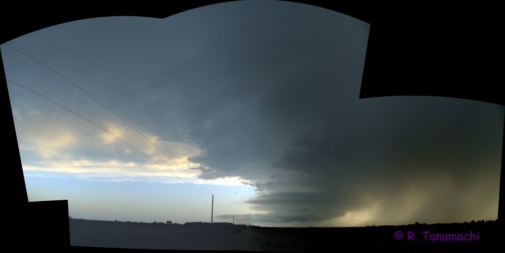
A new supercell near Latimer, KS attracted our attention. At this point we made a strategic mistake – thinking that storm would turn right as it intensified, we headed east on KS-18, south on KS-99, then back west on KS-4, trying to skirt around the core to the east. The supercell, however, didn’t turn right. We could have just as easily headed back into Manhattan and south on KS-177, and intercepted it in about the same place. We ended up adding about half an hour of drive time, and while in transit, we heard reports of a tornado near Latimer. We finally stopped near Alta Vista, KS, and may have seen a dissipating funnel in the diminishing daylight. This view would have to be our reward:

A few more wall clouds developed and dissipated underneath the storm, but the show was over. After taking a few more structure and lightning shots, we called it a night.