Category Archives: Travel

The storm as a national park

Much has been written over the last week about different storm chaser types. Of course, there are as many reasons for storm chasing as there are storm chasers, so trying to categorize them is tricky business. Distinctions like “amateur” and “professional” – often cited by the media in their coverage – don’t make much sense and can vary daily. I wanted to offer up a metaphor that I find useful when I try to explain the myriad reasons for chasing to non-chasers.
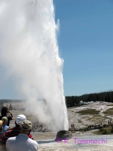
Tourists watch Beehive Geyser erupt
Tourists watch Beehive Geyser erupt in Yellowstone National Park in August 2011. All of them had different reasons for being there.
If you’ve seen any of my public talks in the last few years, you might remember that I open by asking the audience whether they’ve ever been to Yellowstone National Park. (Usually, about two-thirds have.) I then ask, “What if Yellowstone National Park only existed for 4-6 hours, and was moving at 15-60 miles per hour the entire time you were there?” Any national park would work, but I use Yellowstone because it’s one of the most popular, and, at about 9,000 km2, it has roughly the same areal footprint as a supercell. If you want to see Old Faithful Geyser (or better yet, Beehive Geyser, right) erupt, you’d better be able to forecast where Yellowstone will materialize next, know where your target is within the park, and be able to get there quickly.

National parks are public, and open to all (as long as you pay the entrance fee!). Storm chasing occurs at the intersections of two inherently public things: weather and roadways. Therefore, anyone who holds a valid driver’s license is potentially a storm chaser. Some people go out with no intention of storm chasing, but are drawn into the hobby in the moment. To me, proposing to legislate or license storm chasing is about as nonsensical as restricting Yellowstone to only geographers and biologists.
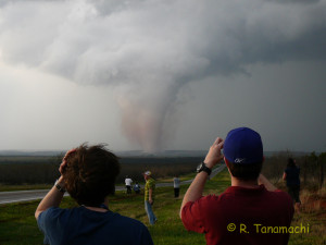
Storm chasers admiring and documenting the 28 March 2007 South Brice, Texas tornado.
People visit national parks for all kinds of reasons: to enjoy nature, for recreation, for photography, for scientific research, to seek thrills, or to spend quality time with their families and friends, to name just a few. Those same motivations apply to people who chase storms. My own motivations vary from day to day – some days I am out to collect scientific data (as with a radar truck), other days, I am out there just to enjoy the sights, sounds, and smells of a storm, test my forecasting skills with my friends, and maybe bring back images or video clips as a souvenir. I can’t claim that my motivations for storm chasing are entirely unselfish. After an encounter with a storm, I often feel invigorated. That motivates me to continue chasing even more than the promise of prestige or monetary compensation.

National parks can be dangerous. Yellowstone in particular has a diverse collection of hazards – scalding hot springs, bears, bison, steep cliffs, avalanches, rapids, etc. (Incidentally, the book Death in Yellowstone offers a fascinating, if morbid, glimpse at those who have perished within the park’s borders, and how they met their ends.) A thunderstorm, too, can imperil the lives of whose who venture within its domain, deserving or not. People can choose whether to educate themselves about the hazards they will encounter in an effort to minimize their risk. As we saw a week ago, however, Mother Nature always gets the last word, and any sense of control that we have over the situation is illusory. Even the most experienced take their lives into their own hands in an encounter with a storm, or a bear. (There’s a reason we call the area beneath the meso “the bear’s cage“!)

It’s not a perfect analog, but it goes a long way towards explaining to non-storm chasers the complexities inherent in trying to categorize storm chasers. Some are there for the storm, some are there for themselves, and others chase for a spectrum of reasons in between. The only thing we have in common is that we are there because the storm is there. Storm chasing is, was, and will continue to be, what we make it.
Fun with a Texas dust devil

The Texas panhandle was crawling with dust devils near yesterday afternoon’s dryline. We were en route back from Boulder, when one of them passed over U. S. Hwy. 87 in front of our car. My husband grabbed my Sony Bloggie 3D and shot this as the dust devil passed over him. He complained for about an hour afterward that he itched from the tumbleweeds scratching against his bare legs!

Minnesota Skywarn Workshop recap

It’s been a busy month! Immediately after the VORTEX2 science workshop, I traveled north to deliver a keynote talk at the 7th Annual Minnesota Skywarn Workshop. What a difference 15 degrees of latitude makes! Minnesota greeted me with a refrigerator chill. I reverted from a summer dress I wore in Texas back to a winter coat and gloves. No great surprise there – when I was growing up in St. Paul, I remember slushing it to the bus stop as late as the first week of May in some years.

The workshop’s organizer, John Wetter (Skywarn coordinator at NWS Chanhassen) had contacted me about a month earlier to ask if I would be interested in speaking. I jumped at the chance to reconnect with the weather community in Minnesota. And yes, I’ll admit to wanting to visit home for myriad personal reasons. They got a keynote speaker, and I got a trip back home. It was a win-win.

John Wetter (in red) introduces me at the afternoon session of the 2013 Minnesota Skywarn Workshop.
John Wetter (in red) introduces me at the afternoon session of the 2013 Minnesota Skywarn Workshop. Thanks, Dad, for the picture!

The workshop featured a nicely balanced cross-section of stakeholders: professional meteorologists (mostly op-mets from the NWS-Chanhassen and Duluth offices), EMs, members of the media, and educators. The audience members ranged widely in age, and all were keenly interested in all the talks. For my part, I spoke about the use of mobile radar in scientific storm chasing, and how it was about more than just pretty-looking data. I covered topics like dual-Doppler, EnKF, and GBVTD analyses, and of course, fresh results straight outta da VORTEX science workshop from which I’d just come. I worked in some networking between sessions. Near the end of the day, the speakers participated in a panel about social media and other factors influencing the future of Skywarn. I was impressed with the workshop organization; everything went smoothly as silk.

My talk was sourced mostly from my own work, but also from a large number of contributors. Here I credit several people who sent me slides, including Howie Bluestein, Jeff Snyder, Jana Houser, Mike French, and Vivek Mahale. I also knew I needed to include some mobile radar data collected in Minnesota in order make the talk locally relevant. (Our observations tend to be Great Plains-centric, just because of fuel costs.) Mike Biggerstaff, Gordon Carrie, and Kyle Pennington generously shared their results from SMART-R observations of the 17 June 2010 Albert Lea, MN tornado (collected during the VORTEX2 “epilogue” period). Thanks, guys!

The organizers were even kind enough to waive the registration fees for a few of my family members, so they got to enjoy the day’s program and learn useful skills like dual-pol radar interpretation. I’m particularly glad my uncle (former EM for Winona County) and aunt made the two-hour drive up to the University of St. Thomas, even though one of their horses was about to give birth. (Incidentally, the foal – a filly – was born the very next morning.)

I spent the balance of the weekend visiting friends and family. I returned to Norman both professionally and personally satisfied. Thanks, John Wetter, for giving me the opportunity to speak at this well-run venue and make a long-overdue visit home!

VORTEX2 science workshop recap

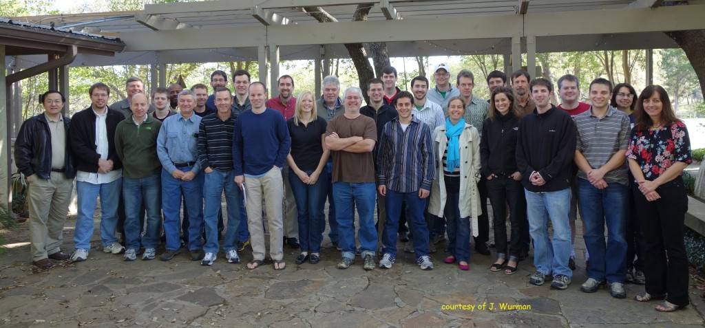
It’s been nearly three years since the field phase of VORTEX2 ended. Two weeks ago, a group of about 30 PIs and scientists reunited at a retreat near Austin, Texas. I was asked to send a few tweets from the workshop since the V2 media liason wasn’t in attendance.

VORTEX2 science workshop group photo

At the end of the field phase, the PIs divided up case studies and initiated collaborations. Over the three-and-a-half days of the workshop, participants updated the group on their most recent findings, including low-reflectivity ribbons (a feature whose significance is still not completely clear), an apparent case of bottom-up tornadogenesis, an uber-composite supercell environment generated from over 700 rawinsonde launches, and UAV transects across multiple gust fronts. There were also discussions about lessons learned (particularly from the UAV group), new tools (EnKF analyses have proven to be a popular tool for filling in the spatiotemporal gaps between observations), and directions for the future.

In the past three years, life has changed for many of the participants. Some have changed jobs or institutions, graduated (waves), or had families. In spite of all this mobility, electronic collaborations and conferences have enabled quick dissemination of results. (It took 10 years for some results from the original VORTEX to see print.) Josh Wurman aggregated a list of all the peer-reviewed VORTEX2-related manuscripts published so far: the paper count currently stands at 14, with 9 more either accepted or in press. It was decided that the group will shift focus in the next few years towards synthesis studies rather than individual case studies.

It wasn’t all work, of course. There was time for some fun, including a zip line ride across Lake Ted!

Minnesota Skywarn Workshop

Just a heads up that I will be giving a keynote talk at the 2013 Minnesota Skywarn Workshop on Saturday, 13 April 2013. As many of you know, I grew up in the Twin Cities, so this venue is a perfect fit for me. I’m looking forward to the chance to visit my old stomping grounds and reconnect with the spotter community up north. Minnesota weather weenies (and yes, I still count myself among them) are a very special breed!
2013 Minnesota Skywarn Workshop

2001-06-11: My first tornado, Benson, Minnesota

The “my first tornado” meme circulating on Facebook prompted me to dust off my first chase log book and relive the Benson, Minnesota tornado – my first ever. I kept an astonishing amount of detail, and it helped me reconstruct the chase. On subsequent chases, I’ve usually been in the driver’s seat and not kept such detailed logs. But when you’re packed in the back of a van with a dozen other students, there’s not much else to do besides observe and record.

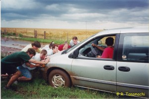
AOS 455 students work to free Van #2 from Kansas mud.
Dr. Tripoli and his AOS 455 students work to free UW Van #2 from Kansas mud. A copy of this photo is still up on the wall of the AOS department at 1225 W Dayton Street.
In spring 2001, I had a freshly-printed B.S. diploma from the University of Wisconsin – Madison’s Atmospheric and Oceanic Science department in hand, and taken a job as a research intern at the Space Science & Engineering Center on Dayton St. I decided to enroll (as a “super senior”) in the biennial summer course AOS 455: Severe Storms Forecasting, taught by Dr. Greg Tripoli. After a couple of weeks in the classroom reviewing mesoscale meteorology, we piled into two white university vans and spent 10 days cruising the Great Plains, chasing turkey towers with Josh Wurman & Co. (who were then rolling in DOW2 and DOW3), sampling the local cuisine (ahem, Taco Tico), pushing the vans out of the greasy red mud, and taking in local sights (e.g., “No trespassing” signs riddled with bullet holes, and a storage facility eloquently named U-STUF-IT). This newly-minted meteorologist from the Midwest found plenty of warmth and charm in the rolling Plains. I distinctly remember watching majestic bubbling cumulus from a parking lot in Harper, Kansas one afternoon, surrounded by fields of waving wheat. I took a deep breath of balmy Gulf air, felt the wind tickle my short hair, and thought to myself, “You know, I could get used to this.”

Near the end of our trip, we migrated back north along I-35 in preparation for our return to Madison. It being early June, the jet stream had begun to migrate north as well. We started off the morning of 11 June in Rochester, Minnesota, and headed north toward St. Cloud. A surface low tracked across northern MN, dragging a cold front behind it, we anticipated the latter would touch off a round of storms in western MN. Wind profiles were marginal, but the air was sticky (72+ F dewpoints, thanks to the exhalations of the corn crop). We banked on the storms generating their own environment.

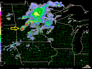
Radar composite of the upper Midwest on 11 June 2001
This HP supercell in western MN (yellow arrow) produced my first-ever tornado. Radar composite courtesy of UCAR.
We stopped for a couple of hours near Olivia, MN, watching backbuilding pulse storms fire off and scoot by to our north. One by one, they marched away to the east like lemmings and collapsed, much to the consternation of our green group of storm chasers, who were straining at the leash to chase something.

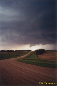
Finally, a new storm west of Willmar began to look better organized. A pay phone call from Dr. Tripoli to nowcasters back in Madison confirmed that was our target. We headed west on U.S. Hwy. 12. As we approached Benson, MN from the east, at around 2015 UTC, we observed a rain-wrapped wall cloud. From our vantage point about 20 miles from Benson, the rain cleared, and in the peach back light of the late afternoon sun, we saw a cloud appendage with a persistent dust whirl beneath it. I had my VHF HT hooked to my belt, and could hear local spotters confirming a tornado in the direction we were looking. I snapped a few pictures before we got back in the van to follow the storm.

Benson, MN tornado of 11 June 2001
My first tornado. We are about 20 mi east of Benson, MN, looking W at 2015 UTC.
We observed a few more wall cloud cycles and dust clouds as we followed the storm back towards Willmar. Tornado warnings followed the storm too, but we never spotted another funnel or tornado. The Benson storm eventually outran us, and we abandoned the chase near Glencoe. I remember making a collect call from a gas station pay phone to my parents in St. Paul, warning them about the approaching hailer. (It did eventually evolve into a mini-bow as it passed over the Twin Cities, and left a fat swath of wind reports across western Wisconsin.) I can’t remember if we drove all the way back to Madison that night or not, but my log book doesn’t have another entry until 14 June.

Heads up, Madison!

I’ll be back in my undergrad stomping grounds to give a talk entitled “Unraveling tornadoes with mobile Doppler radar: Scientific storm chasing on the Great Plains” to the Madison, Wisconsin IEEE section on Friday, 16 November 2012. (The section is generously sponsoring my travel. Thanks, guys!) Here’s their announcement for the talk.

In other news: I’ve got a new job! As of today, I have transitioned to an NRC postdoctoral fellowship at the National Severe Storms Laboratory. I will be working with Dr. Pam Heinselman analyzing phased-array radar data. I’m excited to join her and the Radar Research and Development Division (R2D2)!

Last but not least, please enjoy this sunrise time-lapse I shot from the south rim of the Grand Canyon a few weeks ago on my vacation.

Originally, I uploaded sans audio, but YouTube suggested Carly Comando’s pleasant piano piece “Everyday,” and I decided it was a good fit.

No Time Toulouse

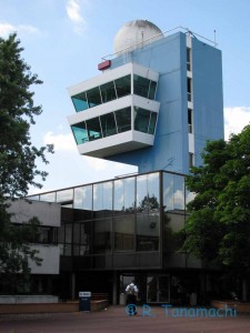
Météo France's Toulouse C-band radar
Sorry it’s been a little quiet around here over the last month, but I think I had a good reason. I was getting ready for my first European radar conference: 7th European Conference on Radar in Meteorology and Hydrology in Toulouse. I’d never set foot in France before, and wanted to put my best one forward!

At the Météo France conference center, I presented a talk (about GBVTD analysis of W-band data we collected during VORTEX2) and two posters (both on EnKF assimilation of mobile radar data in supercells). I reconnected with domestic and international colleagues, as well as making some new acquaintances. Between sessions, we had receptions and banquets at several Toulouse landmarks, including City Hall and the 800-year-old Hotel Dieu.

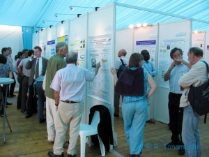
Poster session at ERAD 2012
The poster session of ERAD 2012, held in an air-conditioned tent.
I got to see updated versions of some research presented at last fall’s AMS Radar Meteorology Conference in Pittsburgh, as well as some intriguing new work from my European contemporaries. (There weren’t many tornado talks, but there aren’t as many tornadoes in Europe, after all!) On the final day, there were a couple of talks about radar-based aeroecology (detection and characterization of birds, bats, insects, etc.). Fascinating stuff. Biologists are finding gold in the data that we usually ditch in QC!

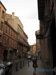
An evening stroll down the streets of Toulouse
Outside the conference, downtown Toulouse was visually pleasing and gastronomically amazing. I took relaxed strolls through the streets and gardens in the evenings, admiring the wrought iron balconies and old chuches, nibbling cheese, and sipping wine. Oh, and taking in Euro Cup matches with the locals, too! The people were, by and large, friendly, and most of the waitstaff at restaurants spoke enough English to get our orders right. I visited 13th-century cathedrals, open-air markets, stunning museums, historic hotels, and verdant gardens.

I figured out early in my stay that I couldn’t possibly pack in all the activities I wanted to do in one week. It’s just as well, because I kept getting lost! And of all the cities I’ve visited, Toulouse was by far the best city to get lost in, slow down, and enjoy.

I’ve returned to find summer baking Oklahoma in earnest. It may not be too long before we dust off the dust devil chasing gear again!