Monthly Archives: June 2011

Downburst vs. tornado damage

My video montage of the 14 June 2011 Norman, Oklahoma downburst* now has over 4,800 views, and is, by far, my most viewed video. I’ve received a number of questions (mostly in the form of comments on the YouTube page) regarding the NWS classification of this event as a downburst or “straight-line wind” event. With such extensive damage to roofs, trees, fences, and power lines, it’s not surprising that some have questioned whether a tornado was responsible. Oklahoma is, after all, famously located in the bullseye of Tornado Alley!
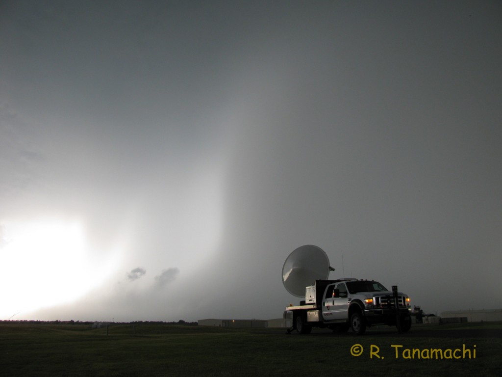
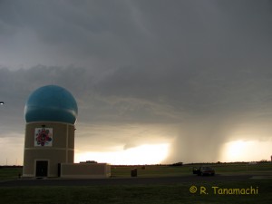
RaXPol deployed at North Base in anticipation of the coming storm.
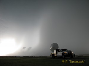
RaXPol deployed just as the rainfoot surged out toward us.

The 14 June 2011 Norman high wind event was a downburst. Hands down. End of story.

1) The damage pattern was divergent and widespread.
Downbursts create different damage patterns than tornadoes. Downbursts form when raindrops evaporate as they fall through a layer of dry air. The evaporation process cools the air, which becomes denser and sinks toward the ground. Upon reaching the ground, it has to spread out laterally, creating a divergent damage pattern, as this diagram from Encyclopedia Britannica illustrates:


In contrast, because of the winds spiraling in toward the low-pressure center of a tornado, the damage patterns tend to be convergent, i.e., inward-pointing, and localized along narrow corridors. Britannica again:

However, owing to Newton’s first law, tornadoes can and do eject (centrifuge) debris, so the tornado-damaged area may contain a mixture of convergent and divergent damage. But, downburst damage patterns never exhibit widespread convergence! By all accounts, the 14 June damage was divergent, spreading away from the damaging storm as it passed over the north and east sides of Norman. In addition, the greatest concentration of damage indicators were spread across an area about 7 km wide – far wider than the widest tornado on record (the 4 km-wide Hallam, NE tornado of 22 May 2004):

2) Doppler radar velocity patterns showed divergence, not tornado vortex signatures.
The Norman downburst, which occurred right on top of the National Weather Radar Testbed, was observed by no fewer than six Doppler radars (KTLX, KOUN, TOKC, MPAR, OU-PRIME, and RaXPol, several of which appear in my video).** Without exception, the Doppler velocity data from these radars showed the near-surface divergence signature characteristic of a downburst, not a tornado vortex signature. This animation from KOUN, one of the radars on north base, courtesy of NWS, shows a “wave” of strong outbound (bright red) winds radiating out and away from the radar site:

3) Of the 500+ tornado-savvy meteorologists living and working in Norman, none reported a tornado.
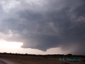
In addition to mechanized observers, there were human observers galore. Of course, not all of them were looking at the storm – some were working, some were home, some were out with their families. But a considerable number, myself included, were out shooting photos or video, and were attentive to the storm’s behavior the entire time. I’d like to think that if there had been a tornado, I would have noticed it. I saw a high-based wall cloud from the north base (visible near the left edge of this photo) several minutes before the downburst struck, but no funnels and no tornadoes. Could hundreds of us have missed a tornado? I don’t think it likely.

Downbursts may not be as photogenic as tornadoes (at least to some people), but they can be just as deadly. Downburst-instigated airplane crashes have killed hundreds of people worldwide. The late Dr. Ted Fujita, who is world-famous for his tornado research, may have saved an equal number of lives via his downburst studies. Thanks in part to his research, specialized, downburst-detecting TDWRs are now installed at major airports. Last summer, I was sitting on a plane at Denver International Airport, when it failed for several minutes to pull back from the gate. Looking out the window, I saw a wall of dust racing toward the airport from the west. My husband speculated aloud that there might have been a microburst, and indeed, his smart phone displayed the divergence signature in data from the Front Range WSR-88D, collected just a few minutes before. We knew what had happened even before the pilot came on the intercom to announce the reason for our delay. And prior to the Norman downburst, no planes took off from or landed at Max Westheimer Airport, which we parked next to. Downbursts are nothing to mess with, particularly when aircraft are involved!

Thanks to Rick Smith and Kiel Ortega for contributing information to this posting.

*Correction: I originally used the word “microburst” in the video title. It emerged later that the damaged area was considerably larger than 4 km in diameter (the characteristic used to distinguish a microburst from a macroburst). I probably should have used the generic term “downburst” (which can include both microbursts and macrobursts) from the beginning. Mea culpa!
**Note: Archived data from the WSR-88Ds and TDWRs is freely available for distribution via NCDC and can be viewed with the Weather and Climate Toolkit. For examples of simulated divergence and vortex signatures, look at Figs. 4.5.1 and 4.5.2 in this online guide.
20 June 2011: Central Nebraska tornadoes

Dan and I were a bit late out of the gate on Monday morning, not departing Topeka until almost 11:30 a.m. We had gone to sleep the night before thinking that the primary action area would be along the Nebraska-Iowa border. However, a shortwave trough ejected out of NM early in the morning, interacting with the cutoff low over W NE.

By the time we got on I-70 and began heading west, we were already hearing reports of an explosive storm close to Hill City, KS. Our friend and colleague Mike Umscheid was chasing it, and as we watched, he began leaving a trail of tornado reports in his wake as he zigzagged north across the Nebraska border. Curses!

We eventually straggled into Smith Center, KS, just as the “children” of Mike’s storm began to race north at 40-45 mph. We crossed the KS/NE border, and proceeded north through Minden to I-80, then west. Crisp updraft towers now ringed us to the north, and low clouds obscured the bases. A tornado-warned supercell near Elm Creek was our target, but as we turned north at the Odessa, NE exit, one of the updraft towers to its east filled in the reflectivity notch on our target storm. We predicted that the storm collision would be detrimental to the western storm and beneficial to the eastern one.

Pleasanton, NE tornado
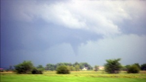
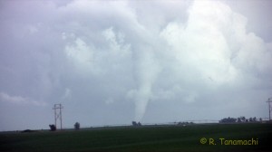
Our first tornado of the day, a white cone near Pleasanton, NE at 4:43 p.m.
We risked the treacherous gravel/mud roads east out of Amherst, NE. Abruptly, a white cone tornado appeared out of the side of an updraft about 8 miles to our NE. We watched it occlude and then erode back into the updraft over the course of about three minutes.

I am a bit confused about which tornado this one corresponds to in the event chronology from the NWS office in Hastings. My camcorder time stamp (which I had just set that morning) reads 4:43 – 4:46 p.m. CDT during the white tornado that appeared to be near Pleasanton, NE, but according to the NWS chronology, the Pleasanton EF-0 tornado ended around 4:40 p.m.

Amherst, NE remnant funnel?
We believe this was a remnant from the Amherst, NE tornado that dissipated 25 minutes before.
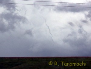
I finally reached NE-10 and turned north, thanking my lucky stars that I hadn’t put my Corolla in another Nebraska back country ditch. As we passed Prairie Center, at 4:55 p.m., we observed a spaghetti-thin remnant funnel to our west. The NWS chronology indicates that the Rockville, NE EF-2 tornado dissipated around this time, but Rockville was to our NE, not to our W. I can only guess that this rope funnel was the last gasp of the much earlier Amherst, NE EF-3 tornado, which NWS indicates dissipated at 4:30 p.m., a full 25 minutes before!

Wolbach, NE tornado
This funnel formed on two colliding outflow boundaries near Greeley, NE around 6 p.m.
Owing to the terrain influence of the North Loup River, we zigzagged NW and E through Rockville, Loup City, Elba, and Scotia, NE, flirting with heavy precipitation cores and strong crosswinds before sighting another tornado along two colliding outflow boundaries north of St. Paul, NE. Although we couldn’t discern ground contact from our vantage point, the funnel, which appeared to be near Wolbach, NE extended more than 50% of the cloud base-to-horizon depth. It was quickly pushed east on the stronger outflow from the western storm, and dissipated about 2 minutes later.

We elected not to pursue the storms any farther north, as we both had to return to work in Norman the following day. We enjoyed a quick steak dinner at Whiskey Creek in Grand Island, before the long haul back south.

Three tornadoes in one day is certainly nothing to complain about; I only wish we could have seen at least one of them while stationary, and been able to film from tripods. Instead, we were on the move, in true chase mode, the entire time. I got zero stills, so the images in this blog post are all frame grabs. Dan ended up shooting most of the handheld video while I drove, some on his camcorder and some on mine, so I’ve split the credit with him for this video summary:

19 June 2011: Alta Vista, KS supercell

We left Norman early in the morning, thinking we might have to make it all the way to E CO to see a supercell. By the time we reached Salina, KS around noon, however, we were waffling between the E CO target, where the shear was better and the cap was weaker, and a more conditional secondary target in NE KS that would probably remain capped until later in the day, but had better moisture. Knowing that the target for the next day might be as far east as Iowa, we decided to opt for the eastern target. We met up with Jeff S., Jana H., and Nick B. in Belleville, KS, where we watched TCU bubble for a couple of hours before some began to take root around 6 p.m. A supercell took shape far to our southeast, then split. We drove to a corn field just east of Manhattan, Kansas, where the left split died over our heads.

A new supercell near Latimer, KS attracted our attention. At this point we made a strategic mistake – thinking that storm would turn right as it intensified, we headed east on KS-18, south on KS-99, then back west on KS-4, trying to skirt around the core to the east. The supercell, however, didn’t turn right. We could have just as easily headed back into Manhattan and south on KS-177, and intercepted it in about the same place. We ended up adding about half an hour of drive time, and while in transit, we heard reports of a tornado near Latimer. We finally stopped near Alta Vista, KS, and may have seen a dissipating funnel in the diminishing daylight. This view would have to be our reward:

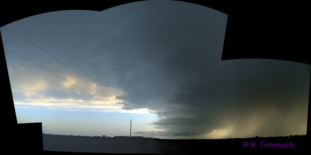
2011-06-19 Alta Vista, KS supercell
Panorama of a weakening supercell near Alta Vista, KS.

A few more wall clouds developed and dissipated underneath the storm, but the show was over. After taking a few more structure and lightning shots, we called it a night.

14 June 2011: Norman, OK high wind and hail event

This video pretty much summarizes the story.

Phased array with rain shaft. Looks innocuous enough.
Dan and I noticed a high-based updraft producing a slender precipitation shaft as we left the NWC yesterday around 6:30 p.m. We decided, on the spur of the moment, to grab our camera gear from the house and head over to North Base to shoot some time lapse near the radar forest.

RaXPol deployed at North Base in anticipation of the coming storm.
RaXPol deployed just as the rainfoot surged out toward us.
As we were taking video and photos, RaXPol pulled up nearby, so we went over to them. As they began to collect volume scans, the precipitation shaft swelled out a the base and rushed out toward us. We witnessed rotor clouds and ascending rain curtains just ahead of it, before becoming engulfed.

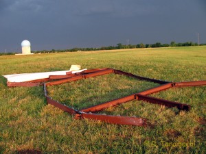
Hangar door debris at North Base
This hangar door blew over 200' from its track to rest in this field. Most of the corrugated metal covering blew away.
For about seven minutes, we experienced bursts of heavy rain, quarter-to-golf ball-sized hail, car-rocking winds, and near-zero visibility. We also saw pieces of metal debris fly across the field from the direction of Max Westheimer Airport. (Later, we figured out that they were from a hangar door that blew off.) We had to shout to be heard over the din of the hail battering the outside of my car. Jackrabbits and a skunk went dashing downwind past us. Nearby ditches and culverts quickly filled with water, and leaves and branches tumbled across the fields.

Social media updates told us of fences blown down, power outages, chimneys partially collapsed, roof shingles peeled away, and lawn furniture either vanishing or appearing where it shouldn’t be. We noted that the damage sounded much worse on the east side, and, having looked at some photos and video from friends of mine who live over there, I believe it!

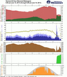
Norman meteogram from 6/14/11
Norman meteogram from 6/14/11. Note the wind spike and other changes at 7:30 p.m. CDT.
The Norman Mesonet meteogram tells most of the story; we were parked just across the field from the station. This event was not entirely a surprise – We were in an SPC slight risk area for convective weather, primarily owing to the threat of strong winds and hail. I may have jumped the gun by labeling this a “microburst” when I uploaded my video; evidently NWS is avoiding that terminology until they do a damage survey. The velocity presentation from the Will Rogers TDWR, however, showed a semi-circular gust front surging toward Norman from the storm in question.

Update: NWS is now characterizing this event as a downburst. You can read their write-up here. They even link to a couple of my photos and video!
Update: My video was also used in an episode of SUNUP TV, an OK State production with a segment provided by the Oklahoma Mesonet, that airs on our local PBS affiliate OETA. Funny thing is, when they requested permission to use the video, I sent them raw clips without the watermark, but what ended up on the air was taken straight off YouTube and still has the watermark. Oh, well!
This video also made YouTube Trends as one of the most viewed in Oklahoma. The two clips on that site are from other people (the first is Mike Coniglio’s, the second from Tornado Titans), but there’s also a link to mine in the end text.

Follett, TX washrag wall cloud

11 June 2011: Texas panhandle funnel and tornado

The southern Great Plains chase season is rapidly dwindling as the ridge builds in. But, we managed to squeak in at least one more chase in the Texas panhandle this past weekend. We brought along Michael H., who just recently joined CAPS. He had never photographed a supercell before, and we thought it likely that we could help him achieve this modest goal for the day.

Pileus cloud on top of a pulsing storm near Buffalo, OK
We were initially attracted to extreme SE CO because of high-resolution model solutions indicating the potential for supercells there. However, we also noticed that those same model solutions indicated that the supercells would grow upscale into an MCS within a few hours. We departed Norman around 11 a.m., reaching the panhandle just after 2 p.m. A cluster of “junk-vection” had developed in the area just south of Woodward, while supercells had indeed begun to pop up in eastern CO – more than three hours away, and very out of play. We gritted our teeth and held up near Logans Corner, OK, where we watched a multi-cell cluster pulse and produce photogenic precipitation shafts, but never quite got its act together. We followed it as far as Buffalo, OK before giving up.

We were a bit disheartened, but took some hope from the fact that it was only 4 p.m. and we had more than five hours of storm environment evolution with which to work. The OK Mesonet indicated that the richer surface moisture hadn’t quite arrived in the Oklahoma panhandle yet. We returned to Logans Corner, OK, where we met up with fellow NWCers Michael C. and Jim C. By then, convection was firing up in discrete, widely-spaced cells stretching from E CO all the way back to central OK. A cell near Spearman, TX caught our attention when it began showing signs of rotation, so we dropped south to Darrouzett, TX. Along with other NWCers (Kiel O. and his entourage), a nicely sculpted LP supercell was there to greet us:

Darrouzett, TX supercell panorama

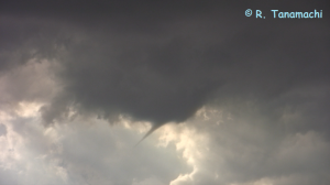
Darrouzett, TX funnel cloud
Brief funnel cloud near Darrouzett, TX.
We watched the supercell spin and creep closer for about an hour. I hadn’t been privileged to witness a southern Plains LP in a while, so I just sat back, enjoyed it, and shot some time lapse. Around 7:13 p.m. CDT, a clear slot began to appear, and the supercell produced a sharply-pointed, photogenic funnel cloud, of which I managed to capture a few seconds of video. (I was trying to tripod, and by the time I got the funnel framed, it had eroded back up into the cloud base and was gone.) Our storm continued to move east, its base increasingly turbulent, producing more and more precipitation as it went. Evidently, the deeper 60+F dewpoints had finally arrived!

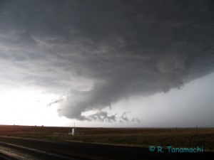
Follett, TX washrag wall cloud
Elongated wall cloud near Follett, TX that produced a brief tornado around 7:43 p.m. CDT.
We headed east from Darrouzett on TX-15, trying to get ahead of the hook. A wall cloud took shape, but was terribly deformed by strong, precip-driven outflow that wrung it out like a washrag. We stopped about 1 mi. W of Follett, TX, just as the tornado sirens blew. I kept waiting for it to fall apart as the storm became outflow-dominant, but somehow, it clung on. A couple of gustnadoes spun out from under it, as well as a brief, near-surface condensation funnel that I’m convinced was part of a brief tornado. (An off-duty NWS employee, Doug S., was parked very close to us and called in a tornado report to the Amarillo WFO.)

After the wall cloud passed by to our north, it quickly filled in with rain. At the same time, a new cell came up to our south, and the two quickly merged as we tried to follow the hook east. We soon found ourselves deep in the murk, blasted by horizontal rain directed variously out of the northwest, north, and northeast. Suspecting a circulation might be forming right in front of us, and lacking radar data, we decided to pull our vehicles over, put the hazards on, and wait until better structure presented itself.

Sunset-lit wall cloud S of Follett, TX
After several minutes, we dropped south out of Follett, initially intending to follow the original target storm (by then near Catesby, OK) along a more southern route. However, in the meantime, a new, classic supercell to our west presented a photography opportunity. We decided to pull over on a dirt road about 12 mi. S of Follett, and shoot this storm at sunset. It produced a beautiful wall cloud with double-tiered structure. We chose, once again, to sit back and enjoy, shooting plenty of video and stills as it passed by us to the north.

We called the chase off at dusk. On the way back, at a Seiling gas station, we happened to encounter Mr. Michael Fish (British TV superstar weatherman) leading a group of chase tourists back to I-35. (I had met Mr. Fish before, taking a previous group on a tour of the NWC.) They were on their last day of a two-week chase trip, and happily reported that they had witnessed a tornado near Beaver, OK earlier in the evening. What a nice way to cap off a tour! I congratulated them, and wished them a safe flight back to the U.K.

Video highlights of the day:

Is it time to modify the (Enhanced) Fujita scale paradigm?

I received many thoughtful and passionate responses to my previous post regarding the upgrade of the El Reno / Piedmont /Guthrie tornado in Oklahoma to EF-5 based, in part on radar observations of 60 m AGL wind speeds. As I noted there/then, the EF scale, as was the F-scale before it is a damage scale, not a wind speed scale. Some have argued that, for this reason, actual wind speed measurements should have no bearing on the EF-scale rating, while others have argued that we should try to incorportate wind speed measurements in EF-scale ratings whenever they are available.

Let’s climb into our “way back machine” and go back to 1971. (Granted, this precedes my own birth by nearly a decade, but I digress.) Dr. Ted Fujita was motivated by the question, “How fast are tornado winds?” Doppler weather radar was still in its infancy, photogrammetry was only possible with high-quality, well-documented film, and in situ measurements of the winds were, logistically, all but impossible to collect (despite valiant attempts to do so). The way I see it, Dr. Fujita asked, “What evidence for wind speeds do tornadoes most consistently leave behind?” His answer: Damage. In 1971, in a paper proposing the Fujita scale, he writes,

“…one may be able to make extremely rough estimates of wind-speed ranges through on-the-spot inspection of storm damage. For instance, the patterns of damage caused by 50 mph and 250-mph winds are so different that even a casual observer can recognize the differences immediately. The logic involved is that the higher the estimate accuracy the longer the time required to make the estimate. Thus a few weeks of time necessary for an estimate with 5-mph accuracy can be reduced drastically to a few seconds if only a 100 mph accuracy is permissible in order to obtain a large number of estimates with considerably less accuracies… high wind-speed ranges result in characteristic damage patterns which can be distinguished by trained individuals with the help of damage specifications…”

Fujita clearly spells out his rationale for the scale; his strategy was to use damage as a proxy for wind speeds in the absence of near-surface wind speed measurements. Forty years later, thanks to innovations like miniaturized, in situ probes and mobile Doppler radar, obtaining near-surface wind speeds in tornadoes is not so far-fetched. Because only a handful of such instruments exist, and deployments are challenging (the presence of a mere tree or building between the radar and tornado can compromise the measurements), we are still not collecting near-surface wind speed measurements in tornadoes with any consistency. And, we are finding that the wind speed bins don’t always match up with the damage indicators in the EF scale.

In my opinion, this means the scale needs to be made more flexible, or possibly supplemented by a wind measurement-based alternative (i.e. two ratings, one damage based and one measurement-based). One could envision expanding the EF-scale into a second dimension (i.e. an EF matrix), the second dimension only expanded if reliable wind measurements (M) are available, and collapsed if they are not. The El Reno / Piedmont / Guthrie tornado would, for example, be rated EF-4 based on its damage, but M-5 based on the RaXPol wind measurements extrapolated to the surface via an objective method.

What I outline above is merely my own half-baked idea, and I am eager to hear other suggestions from people closer to the subject area. I am not a tornado damage expert; I am an observationalist. Keeping the damage-based scale certainly has its merit, primarily in the interest of maintaining consistency with the last 40 years of records (fraught with uncertainty though it may be; see Doswell and Burgess 1988). However, a blanket disregard for reliable remote or in situ wind measurements seems unwise, when obtaining tornado wind speeds was precisely Dr. Fujita’s objective.

.

EF-5 upgrade based on mobile Doppler radar data

The El Reno / Piedmont / Guthrie tornado was upgraded to EF-5* this afternoon, based in part on measured RaXPol Doppler velocities of over 210 mph.

Here’s the relevant portion of the NWS Public Information Statement:
STORM 2... BINGER-EL RENO-PIEDMONT-GUTHRIE

PRELIMINARY DATA...
EVENT DATE: MAY 24, 2011
EVENT TYPE: TORNADO
EF RATING: EF-5
ESTIMATED PEAK WINDS (MPH): GREATER THAN 210 MPH
INJURIES/FATALITIES: UNKNOWN/9
EVENT START LOCATION AND TIME: 8 WNW BINGER 3:30 PM CDT
EVENT END LOCATION AND TIME: 4 NE GUTHRIE 5:35 PM CDT
DAMAGE PATH LENGTH (IN MILES): 75 MILES
DAMAGE WIDTH: UNKNOWN
NOTE: RATING BASED ON UNIVERSITY OF OKLAHOMA MOBILE DOPPLER RADAR MEASUREMENTS.

I’m not certain if this is the first time mobile radar data have been used to upgrade a tornado rating, but it’s certainly an unusual occurrence. (If you know of such an instance, please post a comment!) EF-5 tornadoes are extremely rare events, mobile radar data collection in them, even rarer, and crucial near-surface wind measurements, rarer still. The Doppler velocities in the upgraded EF-5 tornado were collected at 60 m AGL, according to my former officemate and Ph.D. candidate, Jeff Snyder. Since RaXPol is such a new radar, he and other members of Howie’s team have been double- and triple-checking their measurements throughout the past week. So far, I’m told, the data are of reliable quality. But, the data will still have to be subjected to the scientific peer-review process in more formal studies yet to be composed.

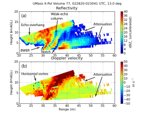
Doppler radar cross-section of the Greensburg tornado
Pseudo-RHI of (top) uncalibrated reflectivity factor and (bottom) Doppler velocities collected in the 4 May 2007 Greensburg, Kansas tornado. Note the weak-echo column down the center of the funnel, indicative of centrifuging of hydrometeors and debris. Also note that no data were collected at altitudes below 1.2 km AGL. From my Ph.D. dissertation. Data collected by UMass X-Pol.
For comparison, on 3 May 1999, a DOW measured winds over 300 mph in the Moore/Bridge Creek, OK F-5 tornado. In a 2002 paper about that data set, it was noted that lofted/centrifuged debris could actually contaminate the velocity measurements near the surface. In the Greensburg, KS, EF-5 tornado, which I studied as part of my dissertation research, Doppler velocities exceeded 180 mph, but only well above the surface. (We deployed too far away from the Greensburg tornado to collect data in that crucial near-surface layer – see the figure at right.)

Remember that the EF scale is not a wind scale. The wind speeds are estimates based on damage (which is the only evidence tornadoes consistently leave behind for us to study), rather than the other way around. For this reason, there may be forthcoming disagreements as to whether Doppler radar measurements can even be used to make an EF-scale determination. Stay tuned…

* An explanation of the EF scale (and how it differs from the original Fujita scale) can be found here.

Correction: The Mulhall, OK tornado was F-4, not F-5, and the 300+ mph measurement was in the Moore/Bridge Creek, OK tornado. Thanks to Roger Edwards and Mike Coniglio for the corrections!