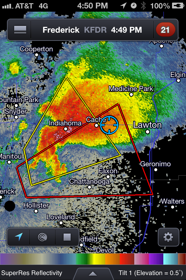
Next, we cut across the forward flank of a tornado-warned supercell passing over KFDR, intercepting it near Cache, OK. Sitting on top of a hill on Cache Road just north of Faxton, OK, we observed a wall cloud to our distant southwest that extended a few enticing purple scud fingers. However, it quickly filled from behind with emerald green and gusted out toward us.
By this point, it was evident that a second supercell – following an almost identical track over KFDR and Manitou, OK – was now the tail end Charlie and the preferred target. Proceeding west along Baseline Rd., we stopped near the intersection with Indiahoma Rd. where we had a good view toward the west and a new wall cloud. Unfortunately, that wall cloud met the same fate as the last one – after rotating lazily, it grew increasingly Z-shaped as an advancing gust front pushed it out from behind.
It was growing darker, and we both needed to return home for logistical reasons. As we merged back onto I-44 at Lawton, we heard a spotter report of a tornado near Ft. Sill, a few miles to our northwest. Our view was blocked by trees, but we could see a dark lowering beneath the cloud base in that direction. We pulled off I-44 for a few minutes to observe, but never saw a tornado or the reported power flashes. We missed the Grandfield tornado, which happened even farther to our southwest, after dark.
By then, the southwest-to-northeast oriented line of supercells was now situated over I-44, signifying a slow and messy return drive. Lou W., who had been nowcasting for us via text message from back in Norman, suggested that we drive straight east through Duncan to I-35, and return to Norman that way. It added about 30 miles to our drive length, but was precipitation-free for all but the last 10 miles. We took the Lindsey Street exit just as our old target storms congealed into a mini-bow. The next morning, my home rain gauge had 2.1 inches of refreshing rain in it.
For your amusement, here’s a video clip from Chris Novy showing spotter network activity during the 17 April event. Despite the number of glowing green ants, we didn’t run into any horde-related issues. We found decent parking spaces and observed safe driving habits all around.