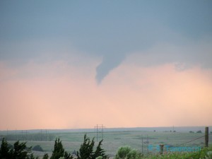
Today, I broke my personal record for the number of tornadoes seen in a single day (9, 10, or 11). Two were small funnels near Freedom, OK; the remainder were produced by a single supercell that we followed from Mooreland to Manchester, OK.

Our mini-caravan consisted of two cars: Jeff S., Howie B., and John L. in the first, while I drove Dan D. and Michael H. in the second. We departed Norman just after noon and drove up the Northwest Passage. From Seiling, we headed north on U.S. Hwy. 281, then west on U.S. Hwy. 412 after the first tail-end Charlie storm. Near Freedom, OK, we caught a glimpse of a slender needle funnel as we crossed the OK-50 bridge over the Cimarron River around 4:30 p.m. About 10 minutes later, just east of Freedom, it again produced a slender needle, both of which we captured on video. We were a bit disappointed at the brevity of both tornadoes; neither lasted more than 30 s. Knowing that a new storm was forming down the line, we decided to end round #1 and head back southwest toward Woodward.
Back on U.S. Hwy. 412, we stopped about halfway between Moreland and Woodward. A second supercell with a vigorously rotating wall cloud churned past us just a few miles to our west, but did not produce any funnels. We followed that storm east along 412 almost to the intersection with U.S. Hwy. 281, where we decided to head south a mile or so and find an unobstructed view towards the next storm erupting back to our southwest. We staked out a claim on a pull-off near the top of a hill, and waited. Several other chasers joined us there.

At some point, we stopped to film again, and I witnessed a bizarre handoff between two tornadoes. (It occurs at about the 3:00 minute mark in the YouTube video above.) One vortex eroded as another descended right next to it. We can be heard disagreeing verbally about whether we were witnessing multiple vortices within the same tornado revolving around a common center, or two separate tornadoes doing a graceful dance. (Mobile radar data could have settled that question, but unfortunately, RaXPol was in the shop.)
We then drove up OK-8 towards Cherokee, OK, with tornadoes (sometimes multiple tornadoes) visible almost all the way there. On our approach to Cherokee at around 8 p.m., I shot my first-ever 3D footage of a tornado with my new Bloggie pocketcam, and was pleasantly surprised by how well it turned out. (I’ll review the camera later.)
Tornadoes continued to snake out of the storm as darkness descended. As the driver of my vehicle, I had to keep my eyes on the road rather than the tornadoes, and I didn’t particularly care about an accurate count. I was simply enjoying sharing the spectacle with my passengers.
Our chase was ended by downed power lines just after dusk, a few hundred feet north of the Kansas border near Manchester, OK. There was still an unmistakable, lightning-illuminated funnel visible to our northeast. That tornado later triggered a tornado emergency for Conway Springs, KS, southwest of Wichita, but thankfully dissipated before reaching town. We made our way back to Norman by way of Enid, OK.
After midnight, as we straggled back into Norman, word began to filter through that a tornado, spawned from a trailing line of storms, had ravaged parts of Woodward, OK. Woodward suffered greatly at the hands of an F-5 tornado in 1947, an event that still figures prominently in Oklahoma lore. Unfortunately, six fatalities resulted, and cleanup and recovery efforts are still ongoing as of this writing. Donations for the victims can be made to the American Red Cross.