My planned blog post for this week was an anniversary retrospective about the Earth Day tornadoes I witnessed near Alanreed, Texas one year ago today. Those tornadoes were somewhat ambiguous in number (between three and seven, depending on who you asked), slow-moving, and accompanied by turquoise precipitation bombs. Little did I know that the scenario would unfold similarly a year later to the day.
I really wasn’t supposed to be chasing today, but brought the car and camcorder to work “just in case.” And even as the front zippered up all the way from Joplin, Missouri to Oklahoma City in about half an hour, I still waffled until the absolute last minute. The crisp convective towers outside my window tempted me outside to shoot some time lapse footage in the NWC parking lot. From there, of course, it was only a quick hop into my car and a straight shot east once one of the line segments transitioned into a supercell.
Our initial target was a supercell east of Seminole, OK, the site of our bust chase last week. However, as we left Norman around 5 p.m., we got stuck behind a large utility truck that couldn’t do more than 45 mph on gentle slopes, and I didn’t feel safe leapfrogging the 20-car convoy that accumulated behind it. Thankfully, they pulled over at a gas station, and we raced east to Seminole. By then, the supercell had moved off to Okemah, and we had become aware of additional supercells developing (including one over east Norman), so we decided to hold up in Seminole for a few minutes to re-evaluate.
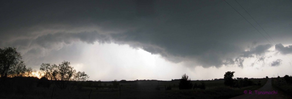
We changed our target storm and intercepted it just east of Shawnee, OK. It produced a brief wall cloud, but its inflow was clearly being contaminated by precipitation from the Norman storm, and we soon lost sight of it in the rain and decided to let it go. We zigzagged back south and west through Shawnee, intercepting the Norman storm near Macomb, OK. It generated a wall cloud, and even a cascading, precipitation-filled clear slot on its back side, but no tornado. We watched it move away alongside a clutch of other chasers.

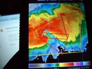
We had to decide whether to continue pursuing the Norman storm as it moved off to the ENE, or drop south to another cell just east of Pauls Valley, OK. Fortunately, storm motions were reasonable (15-20 mph), giving us time to wait for one more radar update to inform our decision. The Norman storm had begun to congeal with its neighbor storms, so the clear choice was to drop south on U.S. Hwy. 177 toward Asher, which we did, coring the Pauls Valley storm as it moseyed east. We never saw any hail larger than dime size. At one point, we experienced a sudden wind shift from NWly to SEly, as a lowering passed by to our north, in the rain. (Later, we received a text message from a fellow chaser, concerned that he had seen us pass almost directly underneath a mesoanticyclone.)
We passed by RaXPol, on her maiden storm chase, parked near the intersection of U.S. Hwy. 177 and OK-59, just east of the town of Byars. We continued south for two more miles, and observed a dark, dense mesocyclone off to our west close to sunset. We stopped near Peach Crest Farm, and watched scud being rapidly ingested into the accompanying lowered cloud base. I knew our odds of seeing a tornado were increasing by the minute. As I drove another mile south, chasers parked along the highway suddenly started waving and pointing their cameras toward the west. We pulled over, and this is what we saw:
The time stamp on my video says 8:00 p.m. at the time of the first funnel, and I had just synchronized my camcorder to GPS time that afternoon, so I’m certain that it’s correct. The second pair of funnels occurred at 8:02 p.m.

We encountered RaXPol, containing classmate/fellow chaser Jeff S., my former adviser, Howie Bluestein, and their ARRC engineer (John). They had collected data in an earlier wall cloud, but did not collect any data in the tornadoes. They decided to call it a night and headed west along OK-59, and we decided to follow. Along the way, we encountered some debris just east of Byars – some sheet metal peeled off a barn was blown from the north to the south side of the highway, gravel scattered across the road surface, and a power pole blown down nearby. As we gingerly tried to navigate the debris, some intellectual luminary two vehicles ahead of me got out, picked up the wet power line with his bare hands, moved it out of the road, then got back into his vehicle and drove away. All I can say is, thank goodness the line was dead! I could have witnessed a Darwin Award in the making. I’ve asked around, and I am apparently the only one who noticed that this happened, and unfortunately, I had turned off my dash cam just a few seconds before, so for all you know I could be making the whole thing up.
As we drove back toward Norman, we witnessed some spectacular lightning in the backsheared anvil. Many of the CGs we saw today (which were numerous – and close – hence our failure to exit the car in the video clip) had spectacular structure, appearing to loop back on themselves multiple times. There was also a terrific display of mammatus, but the sun had already gone down and we could only see the outlines of the “pouches” in the twilight. (Some friends in Norman managed to shoot very nice mammatus pictures – hopefully some of them will let me link!)
I’ve since seen video of a solid stovepipe tornado in the Byars storm, definitely a more substantial one than either of the two tornadoes that showed up in my video. I speculate that the brief funnels that Dan D. and I witnessed may have been vortex arches being drawn up into the Byars storm’s updraft, resulting in a counter-rotating pair of vortices (something I found – twice – in my Ph.D. research on the 4 May 2007 Greensburg tornado). Fascinating stuff!