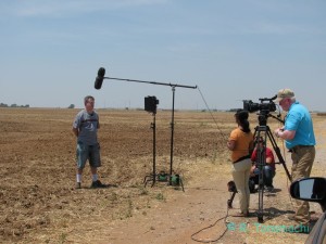
Just a quick note that my husband Dan and I will be appearing this Sunday, Sept. 29th at 8E/7C on The Weather Channel’s “Weather Caught On Camera,” talking about dust devils! They contacted us earlier this summer after seeing some of our dust devil footage on YouTube. We filmed a segment with them near Tuttle back in mid-July, and it will air this weekend!
The storm as a national park
Much has been written over the last week about different storm chaser types. Of course, there are as many reasons for storm chasing as there are storm chasers, so trying to categorize them is tricky business. Distinctions like “amateur” and “professional” – often cited by the media in their coverage – don’t make much sense and can vary daily. I wanted to offer up a metaphor that I find useful when I try to explain the myriad reasons for chasing to non-chasers.
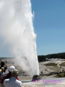
National parks are public, and open to all (as long as you pay the entrance fee!). Storm chasing occurs at the intersections of two inherently public things: weather and roadways. Therefore, anyone who holds a valid driver’s license is potentially a storm chaser. Some people go out with no intention of storm chasing, but are drawn into the hobby in the moment. To me, proposing to legislate or license storm chasing is about as nonsensical as restricting Yellowstone to only geographers and biologists.
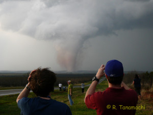
National parks can be dangerous. Yellowstone in particular has a diverse collection of hazards – scalding hot springs, bears, bison, steep cliffs, avalanches, rapids, etc. (Incidentally, the book Death in Yellowstone offers a fascinating, if morbid, glimpse at those who have perished within the park’s borders, and how they met their ends.) A thunderstorm, too, can imperil the lives of whose who venture within its domain, deserving or not. People can choose whether to educate themselves about the hazards they will encounter in an effort to minimize their risk. As we saw a week ago, however, Mother Nature always gets the last word, and any sense of control that we have over the situation is illusory. Even the most experienced take their lives into their own hands in an encounter with a storm, or a bear. (There’s a reason we call the area beneath the meso “the bear’s cage“!)
It’s not a perfect analog, but it goes a long way towards explaining to non-storm chasers the complexities inherent in trying to categorize storm chasers. Some are there for the storm, some are there for themselves, and others chase for a spectrum of reasons in between. The only thing we have in common is that we are there because the storm is there. Storm chasing is, was, and will continue to be, what we make it.
On the passing of Tim Samaras, Paul Samaras, and Carl Young
Very early this morning, I was jarred awake by a rumor that Tim Samaras, his son Paul, and fellow storm chaser Carl Young passed away in the El Reno, OK tornado on Friday. I was unable to independently confirm the rumor, but it originated from a reliable source. The more I thought about it, the more the puzzle pieces fit together: Seven in-vehicle fatalities were confirmed in Friday’s El Reno tornado (which my husband and I witnessed from the vicinity of Union City, OK), of which four had been either publicly identified or described, leaving three people undescribed and unidentified. Tim Samaras’ Facebook and Twitter feeds had both been ominously silent since mid-Friday afternoon. This morning, our worst fears were confirmed by Tim’s brother Jim.
I will admit that I did not know Paul Samaras and Carl Young very well, but likely rubbed elbows with them at chaser conventions, picnics, and meetings. Tim Samaras can introduce himself to you in this “About Me” video on his web site.
I first met Tim in the field in 2004, on a storm chase near the Kansas-Nebraska border. I don’t recall the exact date, but it was one of the first times I had gone chasing in the UMass W-band radar as its primary operator. We found Tim and his TWISTEX crew waiting for CI just north of (I think) Beloit, Kansas. Howie Bluestein (my graduate adviser) introduced me to Tim, and Tim asked if I would be willing to collect W-band radar data over his probes if he had a successful deployment that day. He talked directly to me, not to Howie. Here I was, still relatively new in the field and wet behind the ears, and Tim was inviting me to collaborate! If memory serves, that day was a bust – the cumuli bubbled, but tornadic storms were not to be had.
Tim’s primary instruments in the early 2000s were a set of probes called Hardened In Situ Temperature and Pressure Recorders (HITPRs). A HITPR was about the same size and shape as an Asian conical straw hat, and painted bright orange to make it easy to find if it was moved or covered in debris. The HITPR was basically a miniaturized version of the TOTO probe that was used in early 1980s tornado intercepts, with the distinct advantage of having multiple copies. This 4-minute video from National Geographic shows how Tim used the HITPRs to collect measurements in the 2003 Manchester, South Dakota tornado. These and other measurements confirmed some of our conceptual models about pressure fields in tornadoes.
Tim also built a larger probe, containing seven video cameras, to record a tornado’s passage at close range for photogrammetric analysis. All seven cameras had to begin recording with the flip of a single switch – no easy engineering feat. His probe designs were frequently imitated, but never replicated. The video he took in the 2004 Storm Lake, Iowa tornado is on his jaw-dropping Driven by Passion DVD, which occupies a high spot on my chase DVD shelf and which I still use instructionally to demonstrate the perils associated with flying debris. (A sample can be seen at about 2:40, here.)
Tim’s deployment strategy involved getting very close to tornadoes, but he was NOT one of the debris-kissing yahoos. He had genuine intellectual curiosity and the skills to build instruments needed to address crucial scientific questions. He presented his results eloquently at scientific conferences and submitted them for peer-reviewed publication. He was also a multimedia wizard, perfectly synchronizing side-by-side video and measurement traces. And finally, he was a solid media personality, appearing for several years in National Geographic specials and a season or two on the Discovery Channel’s Storm Chasers with his TWISTEX program. Whenever Tim was on the screen, you knew there would be minimum drama and maximum science.
Tim Samaras’ loss leaves a raw and painful void in tornado research. There is literally no one else in my field who possesses the multifaceted portfolio of expertise in engineering, science, writing, videography, and entertainment that he did. I am still gobsmacked at the news of his passing, and stunned to hear that it occurred so close to us. But the grief of the severe weather research and storm chaser communities can only pale in comparison to the grief endured by their families and friends. My deepest sympathies go out to the Samaras and Young families. They can take comfort in knowing that Tim Samaras and his crew were a class act, universally well-respected, and represented the best of our community.
Update, 7:51 p.m. CDT: My former graduate adviser Howie Bluestein (whom I mentioned above) gave me permission to re-post his tribute to Tim, which was sent out in his daily status message to his colleagues:
Hi all: I am sad and shocked to tell those of you who have not already heard that Tim Samaras, his son Paul, and Carl Young died while chasing the El Reno tornado on Friday. While I have been receiving unconfirmed reports of this since early this morning, the most recent, from Channel 7 in Denver (via Lou Wicker), seems to confirm this tragic news. I have known Tim for many years as someone who shared our enthusiasm for severe weather. He designed some of the early miniature instruments deployed in the paths of tornadoes, particularly those with video cameras and temperature and pressure sensors. His work has been showcased and supported in part by the National Geographic Society, and displayed at the Denver Science Museum. More recently he has been working with high-speed lightning cameras. We have in the past, for a number of years, shared our groups’ status-update messages. He and Roger Hill ran the very successful National Tornado Chasers’ Convention in Denver each February. He was always a gentleman and shared his enthusiasm with the community. While not an academic or a member of a meteorological research laboratory, he has had a profound influence on all of us, and in particular through publications of the analyses of his data from TWISTEX.
The Moore tornado doesn’t necessarily mean more tornadoes
During my interview blitz last week, I was asked by multiple reporters to tie the recent Moore tornado to a presumed overall upward trend in the number of U.S. tornadoes. This was a poorly posed query, for two reasons:
Firstly, it is illogical to conflate a single event (e.g., a car accident) with an trend in those events (e.g., an increase with time in the number of car accidents).
Person A: “I got in a car accident last week, therefore the number of car accidents each year is increasing.”
Person B: “I didn’t get in a car accident last week, therefore the number of car accidents each year is not increasing.”
Neither of these statements make any sense! You need at least two data points to begin to discern a trend, and many, many more to discern a statistically significant trend.
Secondly, although media coverage of tornadoes has undoubtedly increased in the last few decades, to the best of our (researchers’) knowledge, the actual number of tornadoes has not. When adjusted for population growth (read: more eyeballs looking for tornadoes), the trend since ~1950 is essentially flat. Here we see an example of what is known as the availability heuristic: People can more easily recall recent tornadoes than those farther back in the past, especially now thanks to saturation coverage of tornadoes. Viewers may reach an erroneous conclusion that the total number of tornadoes each year is increasing. I’d imagine the same holds true for shark attacks, child abductions, and deaths from falling coconuts.
2013-05-19: South Haven, KS tornado
After a near-midnight arrival at our hotel, we (Dan D., Dan S. Steve W., and I) awoke near Wichita Mid-Continent Airport Sunday morning. We were in prime position at the western edge of our target area, which spanned a considerable longitude band – all the way from Guthrie, OK to Topeka, KS. Our logistical and tail-end Charlie biases urged us to move south. We evaluated the obs and high-res guidance mid-morning, and decided to target an outflow boundary near the KS/OK border. We crossed the border via the Kansas turnpike and sweltered through the lunch hour sitting stationary in Blackwell, OK.
When the Wichita storm attracted our attention, we were hesitant to backtrack north for fear of being suckered. From the McDonald’s parking lot, we watched a steady stream of identifiable chase vehicles pass us headed north on I-35, evident on Spotternet as ant trails. As the Wichita storm grew into an HP supercell, we heard reports of a destructive tornado moving into Wichita – right over the hotel where we’d spent the night, in fact – and wondered if we’d made the wrong decision.
We did eventually backtrack north a few miles into Kansas, targeting the next storm southwest of the Wichita storm near Wellington, KS. It quickly gusted out. We continued south on U.S. Hwy. 81 until it kinked west at South Haven, KS, delivering us into the inflow notch of the next storm in the line. A mile or two west of South Haven, a dense precipitation shaft loomed at the southwest end of the line. As we approached, we observed a dense cluster of chasers parked along U.s. Hwy. 81, watching the approaching hook ball. The time was about 4:35 p.m. CDT.
I happened to lean forward in the driver’s seat and see a finger of white cloud extending down toward the field to our southwest. I quickly pulled off the road and pointed the funnel cloud out to my companions, who jumped out with cameras at the ready.
The narrow South Haven tornado kicked up a small dust whirl in a field less than a mile to our south. At one point, the upper portion of the tornado was almost directly above our car. We darted west briefly, then followed the sinuous vortex back east toward South Haven until it dissipated outside of town.
The South Haven storm congealed into the line and gusted out, so we continued southwest to another non-tornadic cell. Nature called, and I pulled briefly into a gas station in Braman, OK. The town’s tornado sirens went off while I was in the bathroom, and when I came out, I was nearly swept up in a group of customers and employees that was hastily packing itself into the gas station’s freezer. As I walked against the crowd flow towards the front exit, a gas station attendant moved to intercept me, a walkie-talkie in one hand, eyes glinting with concern, arms outstretched as if to grab me and carry me into the freezer. I simply looked him in the eye and sidestepped him, and he let me exit to the parking lot with a shrug.
We hopscotched south and west to each new storm along the line as it back-built into drier air. In the meantime, news of the destructive tornadoes spawned from the Edmond-Arcadia-Carney and Lake Thunderbird-Shawnee storms trickled through to us. We could see the backsheared anvils of both of those storms to our distant south. Our final target storm produced a brief funnel cloud over Blackwell, OK, but we called off the chase near Newkirk when the storm moved over the road hole around Kaw Lake. We made it back to Norman in plenty of time to get a decent night’s sleep for work the next day.
2013-05-18: Rozel, KS tornadoes
Given that it was a moderate-risk Saturday in what had theretofore been a rather lackluster, non-stormy May, we expected Kingfisher-esque crowds of storm chasers in western Kansas. In a bid to reduce the number of cars on the roads, Dan D. and I took two passengers along: Dan S. and Steven. W. of the UK Met Office, who were in Norman for the HWT Spring Experiment. Neither of them had seen a tornado before.
We found the crowds in Greensburg, KS – site of an infamous EF-5 tornado six years earlier. With that heavy history weighing on us, we spent a couple of hours hobnobbing with other chasers, munching convenience store food, and watching elevated showers percolate behind the dryline. In the meantime, a storm up near Ness City began to entice us with a hefty, 60 dBZ hail core and hook echo – but we judged it was too far away, and moving away too quickly, to be a viable target for us. One tower finally solidified northwest of Greensburg around 5 p.m., and we headed up U.S. Hwy. 183 to investigate. Its base was elevated, but persistent. We waffled on whether to stick with this target, or head back south to a less-organized cluster of thunderstorms in Lipscomb Co., TX. We eventually chose the bird in hand, and followed our target storm into Kinsley, KS.
As we drove through Kinsley, our radio crackled to life with reports of a high-based funnel beneath our storm’s still-elevated base. We spotted at least three of them between the buildings and trees. We continued north up U.S. Hwy. 183, and stopped once we noticed that our storm – now a supercell – was merging with a second, more modest cell approaching its right flank. (Part of my current research investigates whether this type of merger is beneficial to tornadogenesis. There are some anecdotes suggesting this might be the case.) We parked about four miles south of the intersection of U.S. Hwy. 183 and KS-156, where we watched the bases of the two storms merge and the cloud base drop.
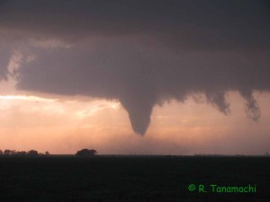
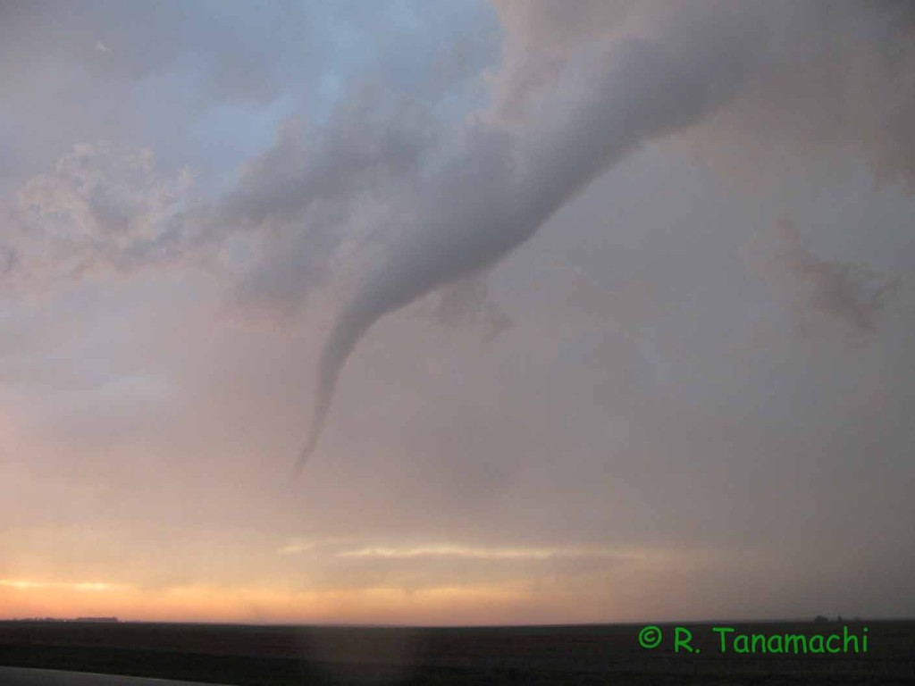
Soon enough, the wall cloud extruded a few rotating scud fingers. We gingerly stepped out of our car (a few CGs were striking too close for comfort) and set up our tripods. Sure enough, around 7:15 p.m., a funnel cloud drilled lazily downward to our west. Over the course of the next several minutes, it morphed into a majestic stovepipe, and finally a symmetric cone with a flared dust cloud around its base. The funnel appeared to occlude at least two times, and disappeared entirely before returning for an encore performance. Our two guests from the UK seemed suitably impressed. This tornado is now known as Rozel, KS, tornado, in reference to the nearest town.
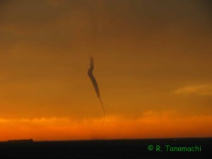
As with the Rozel tornado, the Sanford tornado appeared to dissipate completely before returning for an encore (zombie-nado?). This is why I always try to leave the camera running for an extra minute or two when the show is apparently over! We called off the chase in Larned, KS, before heading to Wichita for the night.
The situation gets serious
I am still getting my bearings back after three straight days of tornadoes. Yesterday, I watched the Moore tornado form from the controls of the KOUN radar on the north side of Norman.
It was my first time to see a tornado while not actively chasing. As I watched it track past me to the northwest and disappear into the murk, I crossed my fingers that it would spare Moore. It didn’t. It crossed I-35 between 4th and 19th street, scattering cars, houses, and people like a mammoth lawn mower. The Warren Theater, where I watched a sneak preview of the new Star Trek movie last week, was damaged and pressed into use as a triage area.
I was ready to write two relatively light-hearted posts about my chases last weekend. I just don’t feel that lighthearted anymore. A co-worker of mine lost her home, but fortunately is not injured. My husband and I are going to go through our garage tonight and gather items to donate to people a few miles away who literally lost everything they own. Honestly, how many times can a nightmare repeat itself?
Quality, not quantity
Yesterday is already wrapping up to be one of my best chases in years. I witnessed two long-lived tornadoes – one at 6:30 p.m. CDT near Rozel, Kansas, and the second at about 8:00 p.m. just north of Sanford, Kansas (which we watched from less than a mile away). I shot more than 40 minutes of video and boatloads of stills, and it is going to be some time before I can sort through and upload the highlights. Unfortunately we have learned that one of the tornadoes destroyed a home in Rozel, and our hearts go out to the victims as they begin to put their lives back together.
Today is also shaping up to be a big chase / tornado outbreak day, and we have some crucial decisions to make. So for now I will just leave you with a teaser. Stay safe today in OK, KS, and MO!
Fun with a Texas dust devil
The Texas panhandle was crawling with dust devils near yesterday afternoon’s dryline. We were en route back from Boulder, when one of them passed over U. S. Hwy. 87 in front of our car. My husband grabbed my Sony Bloggie 3D and shot this as the dust devil passed over him. He complained for about an hour afterward that he itched from the tumbleweeds scratching against his bare legs!
Minnesota Skywarn Workshop recap
It’s been a busy month! Immediately after the VORTEX2 science workshop, I traveled north to deliver a keynote talk at the 7th Annual Minnesota Skywarn Workshop. What a difference 15 degrees of latitude makes! Minnesota greeted me with a refrigerator chill. I reverted from a summer dress I wore in Texas back to a winter coat and gloves. No great surprise there – when I was growing up in St. Paul, I remember slushing it to the bus stop as late as the first week of May in some years.
The workshop’s organizer, John Wetter (Skywarn coordinator at NWS Chanhassen) had contacted me about a month earlier to ask if I would be interested in speaking. I jumped at the chance to reconnect with the weather community in Minnesota. And yes, I’ll admit to wanting to visit home for myriad personal reasons. They got a keynote speaker, and I got a trip back home. It was a win-win.
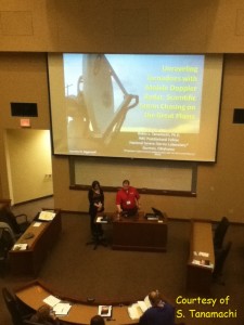
The workshop featured a nicely balanced cross-section of stakeholders: professional meteorologists (mostly op-mets from the NWS-Chanhassen and Duluth offices), EMs, members of the media, and educators. The audience members ranged widely in age, and all were keenly interested in all the talks. For my part, I spoke about the use of mobile radar in scientific storm chasing, and how it was about more than just pretty-looking data. I covered topics like dual-Doppler, EnKF, and GBVTD analyses, and of course, fresh results straight outta da VORTEX science workshop from which I’d just come. I worked in some networking between sessions. Near the end of the day, the speakers participated in a panel about social media and other factors influencing the future of Skywarn. I was impressed with the workshop organization; everything went smoothly as silk.
My talk was sourced mostly from my own work, but also from a large number of contributors. Here I credit several people who sent me slides, including Howie Bluestein, Jeff Snyder, Jana Houser, Mike French, and Vivek Mahale. I also knew I needed to include some mobile radar data collected in Minnesota in order make the talk locally relevant. (Our observations tend to be Great Plains-centric, just because of fuel costs.) Mike Biggerstaff, Gordon Carrie, and Kyle Pennington generously shared their results from SMART-R observations of the 17 June 2010 Albert Lea, MN tornado (collected during the VORTEX2 “epilogue” period). Thanks, guys!
The organizers were even kind enough to waive the registration fees for a few of my family members, so they got to enjoy the day’s program and learn useful skills like dual-pol radar interpretation. I’m particularly glad my uncle (former EM for Winona County) and aunt made the two-hour drive up to the University of St. Thomas, even though one of their horses was about to give birth. (Incidentally, the foal – a filly – was born the very next morning.)
I spent the balance of the weekend visiting friends and family. I returned to Norman both professionally and personally satisfied. Thanks, John Wetter, for giving me the opportunity to speak at this well-run venue and make a long-overdue visit home!