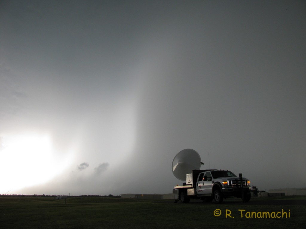
My video montage of the 14 June 2011 Norman, Oklahoma downburst* now has over 4,800 views, and is, by far, my most viewed video. I’ve received a number of questions (mostly in the form of comments on the YouTube page) regarding the NWS classification of this event as a downburst or “straight-line wind” event. With such extensive damage to roofs, trees, fences, and power lines, it’s not surprising that some have questioned whether a tornado was responsible. Oklahoma is, after all, famously located in the bullseye of Tornado Alley!

The 14 June 2011 Norman high wind event was a downburst. Hands down. End of story.
1) The damage pattern was divergent and widespread.
Downbursts create different damage patterns than tornadoes. Downbursts form when raindrops evaporate as they fall through a layer of dry air. The evaporation process cools the air, which becomes denser and sinks toward the ground. Upon reaching the ground, it has to spread out laterally, creating a divergent damage pattern, as this diagram from Encyclopedia Britannica illustrates:

In contrast, because of the winds spiraling in toward the low-pressure center of a tornado, the damage patterns tend to be convergent, i.e., inward-pointing, and localized along narrow corridors. Britannica again:

However, owing to Newton’s first law, tornadoes can and do eject (centrifuge) debris, so the tornado-damaged area may contain a mixture of convergent and divergent damage. But, downburst damage patterns never exhibit widespread convergence! By all accounts, the 14 June damage was divergent, spreading away from the damaging storm as it passed over the north and east sides of Norman. In addition, the greatest concentration of damage indicators were spread across an area about 7 km wide – far wider than the widest tornado on record (the 4 km-wide Hallam, NE tornado of 22 May 2004):

2) Doppler radar velocity patterns showed divergence, not tornado vortex signatures.
The Norman downburst, which occurred right on top of the National Weather Radar Testbed, was observed by no fewer than six Doppler radars (KTLX, KOUN, TOKC, MPAR, OU-PRIME, and RaXPol, several of which appear in my video).** Without exception, the Doppler velocity data from these radars showed the near-surface divergence signature characteristic of a downburst, not a tornado vortex signature. This animation from KOUN, one of the radars on north base, courtesy of NWS, shows a “wave” of strong outbound (bright red) winds radiating out and away from the radar site:

3) Of the 500+ tornado-savvy meteorologists living and working in Norman, none reported a tornado.
In addition to mechanized observers, there were human observers galore. Of course, not all of them were looking at the storm – some were working, some were home, some were out with their families. But a considerable number, myself included, were out shooting photos or video, and were attentive to the storm’s behavior the entire time. I’d like to think that if there had been a tornado, I would have noticed it. I saw a high-based wall cloud from the north base (visible near the left edge of this photo) several minutes before the downburst struck, but no funnels and no tornadoes. Could hundreds of us have missed a tornado? I don’t think it likely.
Downbursts may not be as photogenic as tornadoes (at least to some people), but they can be just as deadly. Downburst-instigated airplane crashes have killed hundreds of people worldwide. The late Dr. Ted Fujita, who is world-famous for his tornado research, may have saved an equal number of lives via his downburst studies. Thanks in part to his research, specialized, downburst-detecting TDWRs are now installed at major airports. Last summer, I was sitting on a plane at Denver International Airport, when it failed for several minutes to pull back from the gate. Looking out the window, I saw a wall of dust racing toward the airport from the west. My husband speculated aloud that there might have been a microburst, and indeed, his smart phone displayed the divergence signature in data from the Front Range WSR-88D, collected just a few minutes before. We knew what had happened even before the pilot came on the intercom to announce the reason for our delay. And prior to the Norman downburst, no planes took off from or landed at Max Westheimer Airport, which we parked next to. Downbursts are nothing to mess with, particularly when aircraft are involved!
Thanks to Rick Smith and Kiel Ortega for contributing information to this posting.
*Correction: I originally used the word “microburst” in the video title. It emerged later that the damaged area was considerably larger than 4 km in diameter (the characteristic used to distinguish a microburst from a macroburst). I probably should have used the generic term “downburst” (which can include both microbursts and macrobursts) from the beginning. Mea culpa!
**Note: Archived data from the WSR-88Ds and TDWRs is freely available for distribution via NCDC and can be viewed with the Weather and Climate Toolkit. For examples of simulated divergence and vortex signatures, look at Figs. 4.5.1 and 4.5.2 in this online guide.
Information about this distinction can also be found at:
http://www.flame.org/~cdoswell/publications/F-scale_Assess_Guide.pdf
See pp. 36 ff. This document is freely downloadable. Robin’s figures are excellent!