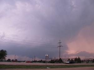
For those who aren’t familiar, Rocky Rascovich’s annual chaser picnic in Piedmont, OK is a local institution. It usually occurs on a Saturday in May, when skies are blue and there’s nothing to chase. Not only does it give the local (and vacationing) storm geeks a place to hang out, eat some burgers (prepared by his industrious wife Dee), ogle each other’s chase videos, and compare stories from the past year, but it gives the chase tour groups something to do on a down day.
I woke up honestly not expecting to chase today, and busied myself preparing a dish to pass at the picnic. I was dimly aware that there was an SPC-issued slight risk and 5% tornado contour out to our east, but figured it was going to be out in the SE OK jungle. (I was a little jaded from our clear-sky bust on Wednesday.) As I hobnobbed at the picnic with Rocky, Chris Novy, Bill Hark, et al., we checked the SPC mesoanalysis page periodically, but assumed that the big show would be out east on I-40 on the progged dryline bulge.
We left the picnic around 5:30 p.m. and headed back toward Norman. Even as we left Piedmont, we could see a crisp updraft tower to our distant south. As we approached Norman, it hit the tropopause and began to spread anvils both upshear and downshear. The radar presentation on Dan’s Radarscope looked more and more supercellular, so we decided to blow by home and keep heading south on I-35.
New cauliflower updrafts continued to swell up the storm’s rear flank, and by the time we reached the Sulphur exit and headed east on OK-7, a funnel cloud and tornado report had appeared on Spotter Network. All our gear was still in my trunk, so we didn’t get any video until we stopped on the east side of Sulphur around 7:30 p.m. Almost immediately, we were rewarded with a funnel cloud, followed by a couple of brief condensation funnels near Hickory, OK about 10 minutes later, all of which Dan reported on Spotter Network.
After that, we lost about 30 minutes enduring a “bungle in the jungle” after trying to cut east from OK-1 to U.S. Hwy. 377 along an intermediate county road. I danced my Corolla around in the mud and forayed down a dead-end road that our mapping software indicated was continuous. (We passed several other chasers who were also led astray.) We lost our data feed while navigating the back roads, but eventually regained it when we emerged near Fittstown, OK. By then, our target storm was trending downhill, while a second storm near Ada, OK (whose initial convective towers we had bypassed on our earlier drive south to get to the Sulphur/Hickory storm) had exploded into classic textbook supercell structure.

Once it grew dark, the Ada supercell filled in completely with precipitation, and its radar presentation began to deteriorate. We called the chase off, and drove home to radio coverage of the Oklahoma City Thunder’s unenviable 93-87 loss to the Dallas Mavericks (despite their best efforts). At least we had an unexpected “win” today: Not only did we see several tornadoes, but so far as we know, there were no damage or injuries resulting.
Update: My husband posted his “director’s cut” of our chase here:
Great catch! I have a timelapse of the supercell on facebook: timelapse