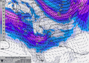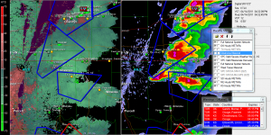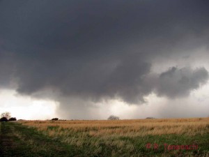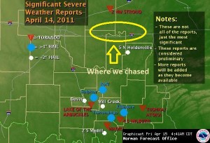
The day started out with great anticipation. A negatively-tilted trough, along with other favorable ingredients, had appeared in model runs for several consecutive days. Originally, the prospective target was the eastern Oklahoma-Kansas border, around Bartlesville. We’d already arranged a three-car caravan to go chasing, including several new/guest chasers, thinking the odds were pretty good that we could bag them a first tornado.
About 24 hours before chase time, it became clear that the trough was digging farther south than originally thought, so we shifted our target south into eastern Oklahoma, where SPC had delineated a moderate risk area with extensive discussion about favorable conditions for supercells all along the dryline. Concerns about lack of low-level moisture return were allayed by mid-60s dewpoints spread across eastern Oklahoma (as seen by the Mesonet) on Thursday morning, and a strong signal appeared in both the NSSL WRF and HRRR models for isolated supercellular convection in eastern Oklahoma, south of I-40. In the meantime, the warm sector north of the Kansas border looked more and more like an uncapped mess, so we decided to eliminate it from our target.
Our caravan departed Norman just after lunchtime, stopping along I-40 north of Seminole as convective towers began to bubble all along the dryline. The “tail-end Charlie” storm near Atoka, OK, about 60 miles to our south, quickly became dominant. However, we were reluctant to blast south after it, because it would have meant committing to a storm that would certainly move into difficult, forested, hilly terrain, while further eliminating the northeast quadrant of Oklahoma from our target area, where other storms with wall cloud and funnel cloud reports were already occurring.


As we zigzagged north and east through Morris, OK, nickel-sized hail pelted our caravan. It didn’t make us feel much better that the Atoka storm, well out of our reach to the south, was leaving a trail of tornado reports in its wake. As we passed the wind profiler station near Haskell, OK, its measured wind profiles indicated a weakness in the hodograph between 1 and 3 km above the surface – a possible clue as to why these storms seemed almost incapable of generating persistent low-level rotation. We eventually called off the chase after dark, just north of the town of Wagoner, east of Tulsa. We were treated to some spectacular ground-to-cloud lightning, a consolation prize of sorts, on the drive home.

For those who are curious what we missed, I’ll link to this video shot by our friend Gabe G. and his chase partners.
Unfortunately, this tornado caused two fatalities, numerous injuries, and extensive damage in Tushka, OK. In light of that, our bust chase seems pretty trivial.
To their credit, our guest chasers were all very good sports about the situation. A couple of them can’t wait for another chance to chase, and it looks like there are, indeed, other opportunities peeking over the horizon.