All posts by tornatrix

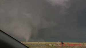
The Elmer - Tipton tornado emerging from the rain at 5:46 p.m

Chase log for May 2015, including the 05-16 Elmer / Tipton, OK tornado

Having fallen woefully behind on my chase logs, let me briefly summarize this month’s action so far with a bunch of mini-logs. Many of the longer-range excursions were made possible by a very patient babysitter. Thanks, Miss Autumn!

05-06-2015: Lahoma – Chisholm – Wakita, OK storm Chase partners: Dan D., Jeff S. Nick B., Hamish R.
We headed up toward a prospective S KS target initially, but stopped near Lamont, OK when we heard about a tornadic storm brewing near Chickasha. Not wanting to be suckered into dropping all the way back south, we held up in Pond Creek, watching nascent storms organize. From there, we zigzagged southwest to intercept a beautifully-sculpted supercell near Lahoma that teased us with a few condensation filaments.
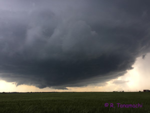
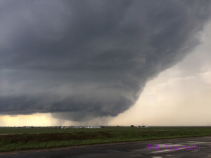
Lahoma, OK supercell, view toward the W
The same storm, later that evening, near Wakita, OK

Nick believes at least one of them connected with the ground.


From there, we basically reversed our zigzag as we paced the ex-Lahoma storm back toward the northeast, passing through Chisholm, Lamont, and Pond Creek. Meanwhile, we each had an eye on a robust supercell bearing down on Norman, fielding calls from our babysitter about where she and our son should shelter in the worst case scenario. The storm eventually spawned an EF2 that affected the west side of town, and dropped some one-inch hail at our house. Back up north, we finally called the chase off near South Haven, KS. We returned back to Norman close to midnight, witnessing a pocket of damage near 51st street in South OKC on the way, evident from the power outages.

05-08-2015: Norman hailstorm Chase partners: D3
This wasn’t really a chase, but an in situ sampling of severe weather nonetheless. While Dan D. was off chasing near Wichita Falls, I agreed to operate KOUN in the evening. At 5 p.m., I had to leave the KOUN building to collect my son from day care. I was aware of an anemic-looking cell brewing over Blanchard, as well as a larger complex of storms to the west. With no real-time display available, I pointed the KOUN sector to the west and set it a bit wider than usual, then left the site. As I made the drive to day care and back, the sky first grew dark, then green. Simulcast TV coverage on the radio informed me that the situation in west Norman had deteriorated quickly. My son chattered excitedly from the back seat, “Storm there?” Then, as I passed the hallowed ground of 1313 Halley Circle, the hail and driving rain began to fall in earnest. I had planned to grab my son and dart into the building as quickly as I could, but as soon as I opened my car door, I was blasted in the face with one-inch-diameter hailstones and blinding rain.


The Blanchard storm had indeed intensified and generated both a hook echo, and a swath of 2.5″ hail near Tecumseh & I-35 (about a mile to my north). Once the icy battering subsided, my son and I went inside together, where I found KOUN merrily collecting data in the sector I’d left it on. I hope it captured the rapid intensification. (I offloaded the time series to someone else who will process it later this season.) After about 6:30 p.m., with the Norman storm now well off to the east and an antsy toddler trying to climb out of his playpen, I decided to call it a night, and returned control of KOUN to the ROC. Naturally, as we were driving home, the ex-Norman storm reintensified and produced a tornado near Shawnee. Garbage! KOUN was still collecting in VCP 11, so it captured this event, just not in the rapid-scan mode I’d been using earlier.

05-09-2015: Near-miss at Burkburnett, TX Chase partners: Dan D., Jeff S., Nick B., Steve W.
Our initial target on this day was Wichita Falls, TX. A supercell had already gone up near Abeliene and was happily producing tornadoes, but it was too far south to be a viable target for us. We contemplated targeting two developing storms: one near Jacksboro, TX, and one nearer our latitude, approaching Electra, TX. We opted to take a look at the Electra storm, leaving the option open to drop south to Jacksboro. We moved a couple miles north of U.S. Hwy. 287 on Harmony Rd., and took in the Electra storm as it surged forward to swallow us into its navy blue maw.
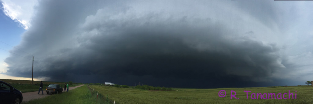
Supercell approaching Electra, TX at about 5:45 p.m.
We darted back south to escape the approaching RFD, and then retraced our route back southeast on U.S. Hwy. 287. We chose to forgo an intercept near Burkburnett, TX, prioritizing a run back across the TX-OK border on either I-44 or TX-79. Big mistake! The Electra storm abruptly hooked right, and we heard chatter on the NWS spotter frequency about a tornado crossing the road near Burkburnett. By then we were deep into Wichita Falls, and could not recover back to Burkburnett in time. By the time we did reacquire a visual on the business end of the storm near Byers, TX, it had lifted across the Oklahoma border and gusted out. After crossing at I-44 after all, we paced the whale’s mouth east along U.S. Hwy. 70 for nearly 40 miles before finally calling it quits. We licked our wounds over a nice dinner at Two Frogs Grill in Ardmore, OK.

05-16-2015: Elmer-Tipton, OK tornado Chase partners: Dan D., Jeff S. Steve W., Mark S., Mike C.
After considering targets ranging from Shamrock to Childress, we decided on the latter, and headed southwest in a three-car caravan. As we drove first down I-44, then west on U.S. Hwy. 62 from Lawton, storms near the northern end of our target range quickly congealed and squalled out. We watched Spotternet icons bail south on U.S. Hwy. 83, converging on the Childress, TX area, where a storm near the southern end of our target was showing promising signs of rotation. The fields around Altus were shiny with standing water, and we were justifiably concerned about going off pavement. We headed south from Gould to Eldorado, where we decided to attempt an intercept on the ex-Childress storm, now crossing the Red River. Rather than heading northeast on OK-6, we chanced E1750 Road because it was marked as “paved” on Roads of Oklahoma. (It was, for all but one mile.) We paused briefly at a service station near Elmer, OK, to watch the storm approach from our southwest, encountering numerous other chasers at the intersection with U.S. Hwy. 283. With no east option out of Elmer, we hedged north and then east on OK-5.

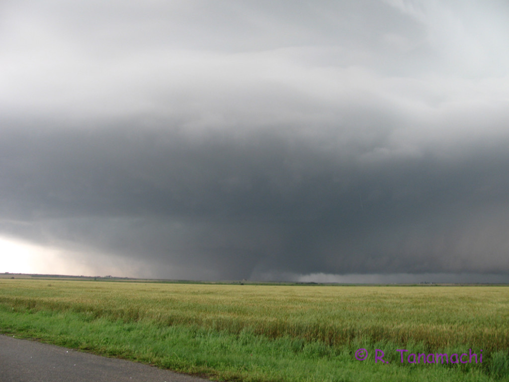
We stopped on N2080 Rd and watched the supercell approach. Tornado warnings began to blare from our weather radio, but all we could see beneath the “wedding cake” and beaver tail was murk.
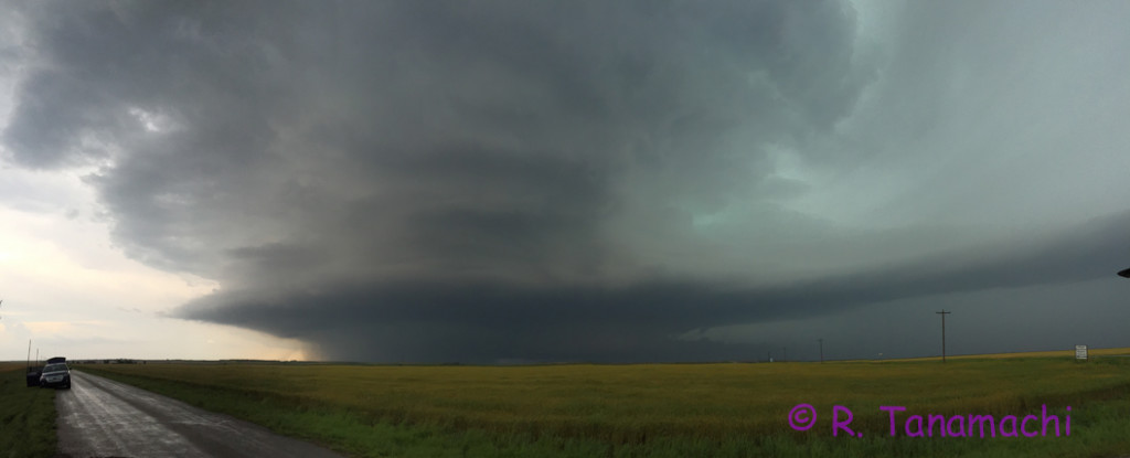
The Elmer-Tipton storm at  about 5:42 p.m., after the tornado warning was issued, but before we could see the tornado.
The Elmer-Tipton storm at about 5:42 p.m., after the tornado warning was issued, but before we could see the tornado.

Then, suddenly, there it was, emerging from the rain like a wraith:
The Elmer - Tipton tornado emerging from the rain at 5:46 p.m
The Elmer – Tipton tornado emerging from the rain at 5:46 p.m.

I stood behind our Prius V., attempting to tripod my camcorder. I was so mesmerized by the sight that I failed to perceive the giant hail cratering the ground around me. (White streaks can be seen in the photo above.) A baseball exploded on the ground by my feet, and my husband’s frantic admonitions finally registered. I ducked under the open hatch, taking my camcorder with me. I couldn’t risk running around to the driver’s side door, so I simply climbed into the boot of our Prius V and pulled the hatch closed behind me. From there, it was an awkward crawl over Steve W. in the back seat, up to the driver’s seat. In my haste, I left the camcorder back in the boot, so unfortunately my video ended there. I contented myself with sending a tweet or two from my seat. My husband, however, managed to get some nice shots, which can be seen in this summary:

When the tornado was about 3/4 mi away, we decided to reposition a few miles east. Our car stopped 2 mi W of Tipton, while Jeff S. and Mark S. stopped about 1.5 mi W of us, near the North Fork Red River bridge. They were actually much closer to the tornado as it cross OK-5; Jeff S. claimed he could hear the “waterfall” sound as the white cone passed them:

From our vantage point, I’m fairly certain that we witnessed the formation of a brief, second funnel to the northeast of the primary tornado.

I’ll be curious to see whether any of the mobile radar data collected this day supports this second tornado. The damage survey (conducted the following day) doesn’t seem to:

From Tipton, we followed the hordes east on OK-5C to Manitou, then north on U.S. Hwy. 183, then east on U.S. Hwy. 62 again. Every time I glanced back over my shoulder at the hook area of the supercell, all I saw was a rotund, turquoise curtain of rain. According to the surveyed track above, however, the tornado continued to hypotenuse ENE from Tipton to Snyder, OK, where it finally dissipated.

Our group determined that it would probably be better to drop south to the next storm in the line, which was headed for Grandfield, TX. From Indiahoma, we dropped south to Chattanooga, watched an intermediate storm gust out from near the intersection of OK-36 and OK-5, then finally made a last stand at Randlett before calling it a night. On our way back via Duncan, we heard reports of a new tornado near Geronimo, generated by the ex-Elmer storm.

05-23-2015: Mini-supercell bust near Alex, OK, flooding in Purcell Chase partners: Dan D., D3
We had basically blown off Saturday’s chase prospects because it looked like the primary target (vicinity of Lubbock, TX) was too far away. We were quite astonished later when Jeff S. called us to report a large tornado in progress near Minco, as seen on television. As we switched on our TV, another touched down near Newcastle, just west of Norman. Mini-supercells (a.k.a. low-topped supercells) were developing all across south central Oklahoma in advance of an approaching MCS. We jumped in our car and intercepted a couple of these diminutive supercells down the line, one near Blanchard, and another near Alex, OK, only to watch them shrivel as they were undercut by the gust front surging out ahead of the slow-moving MCS. D3 was a very good sport, watching the rain and lightning from his car seat. We didn’t want to stray too far from home on his account, so we stuck a fork in our chase a little earlier than usual and headed back to Norman via OK-39. The route took us through Purcell, where we encountered some pretty serious street flooding. I was afraid our Prius V might stall out; in some places the water as as deep as 8 inches. We trailed some taller vehicles to gauge the water depth, and made it back to I-35 without incident.

As the evening progressed, the MCS all but stalled out over over us, dropping 6″ of rain at our house. We heard of flooding all over Norman, particularly in East Norman close to Lake Thunderbird. One of our favorite local restaurants, Clear Bay Cafe, posted on FB that they were closed due to flooding. They are only open during the summer, and I imagine this is a season-ender for them. Some of our friends also found water intruding into their homes overnight. Our house is located partway up a hillside, so we had no issues at our house. However, the land just to our east was recently graded for construction of a new subdivision, and tons of bare soil washed downhill, filled our streets with red mud, and narrowed Dave Blue Creek. In the image below, you can see some of the construction equipment in the background.

Clarifications & corrections regarding the burning car photo

Sadly, at least one person perished today in an incident involving a car fire inside the dock area of the National Weather Center. A photograph I took of the burning vehicle has been retweeted hundreds of times and appeared on a number of major news outlets accompanied by information of varying accuracy. I want to set the record straight about a couple of things I’ve heard and read regarding the image.

1. I didn’t actually witness the incident. At about 3:35 p.m., I came out of my 4th floor NWC office to refill my tea kettle, and noticed a group of people, including my husband, looking and pointing at something outside the bay windows on the northeast side of the building. I could see smoke billowing from somewhere southeast of the building, but couldn’t see the source, and decided to look out the window on the end of the east wing. When I got there, I fully expected to see a grass fire on Hwy. 9 (as often happens when people carelessly flick cigarette butts out their car windows). Instead I was astonished to see this scene in our own dock area:


2. I didn’t break any rules or disobey any instructions to get the image. As I took the photo, the PA finally chimed on: “May I have your attention, please. An unsafe condition has been reported on the east side of the building. Please move toward the center of the building.” For those not familiar with the NWC, it is an L-shaped building with wings pointing toward the north and east, and an atrium area at the elbow. I tweeted the image as I was walking away from the east window, toward the atrium, because I knew all my colleagues in other parts of the building would be wondering what the ambiguous “unsafe condition” was. I wanted to give them a way to see what was happening without having to look for themselves.

3. The image is indeed mine. My husband, who was standing right next to me, took his own photo within seconds of mine, also tweeted it, and it was also used by a number of news outlets. It looks nearly identical, but some details (such as the position of the police officer standing just outside the gate) are different.

4. The radar trucks in the upper left part of the image are SMART-Rs, not DOWs. SMART-Rs (Shared Mobile Atmospheric Teaching and Research Radars) operate at C-band and are jointly owned and operated by OU, NSSL, Texas Tech, and Texas A&M. DOWs (Doppler on Wheels) operate at X-band and are owned and operated by the Center for Severe Weather Research in Boulder, Colorado. Although the two types of radars are used for similar severe storms research (and both operated together in VORTEX2), they represent two separate research groups.

5. The building was never evacuated. We were advised to move to the interior and shelter in place. This was likely done to prevent anyone trying to evacuate through the dock area.

6. I don’t know any more than you do about what happened. The only verifiable facts are that the car rammed through the gate (as is evident in the photo), the car burned, and one (male) person died (stated by Norman FD to several local media outlets). As of this writing, more than six hours after the incident, the bomb squad is still working on the burnt-out car. Beyond that, I consider any information about details, cause, motive, or extenuating circumstances to be only rumors and speculation. I’m satisfied to let the investigators do their jobs and notify the next of kin (who are doubtless in shock). I await a formal statement from OU Public Affairs about this incident.

2015-03-25: Moore, OK tornado and damage survey

Wednesday’s non-chase consisted of me looking up from my son’s bowl of mac and cheese, and seeing a tornado out the window. Okay, there was a little more to it than that. But lately, the storms have considerately come to me when I can’t chase. It’s one of the reasons I live in Norman!

I was aware of the SPC’s moderate risk for severe weather, but I had all but dismissed the tornado risk based on the crashing cold front setup. That setup had burned me too many times in the past. I’ve driven hundreds of miles just to watch nascent storms wither as a relentless southward surge of cold air sliced the legs out from beneath them, leaving me low and gas and without much to show for it. Instead, Wednesday’s storms latched onto the front and rode it south and east. We followed coverage on a couple of the local news networks, watching with rapt fascination as a storm that appeared postfrontal and undercut produced a 30-second funnel cloud near El Reno, OK.

Moore, Oklahoma tornado on 2015-03-25
As seen from near my home in southeast Norman.
Fast forward about an hour: the same storm marched onward to Moore, and in helicopter video, power flashes erupted all over the I-35 corridor. My husband, who had been admiring the mammatus under the anvil in our driveway, suddenly charged into the house, shouting, “I can see it!” I grabbed my son and we dashed across the street. To the north, between two houses, a tapered funnel cloud was clearly visible. I didn’t have time to grab my “good” camera, only got a few grainy pictures with my iPhone. This counts as my son’s first (ex-utero) tornado.

As the damage reports filtered in, and the complexity of the situation became clear, I felt inspired to email some people in the know about participating in the damage survey the next day. It may come as a surprise to some that I’ve never actually participated in a tornado damage survey before. I resolved this year that I would assist in at least one in order to learn firsthand, from the experts, how it was done. By the next morning, I had an invitation. Doug Speheger of the Norman NWS-WFO was gracious enough to let me join his team as they surveyed part of the preliminary track. Rick Smith, the WCM for Norman, tasked us with characterizing the event and focusing in directionality of wind damage indicators (DIs). Signals of a mixed-mode (tornado / straight-line wind) event were already evident in video and reports from the day before.

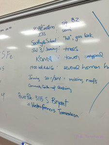
The Moore EOC whiteboard
The Moore EOC whiteboard listing preliminary damage reports as they came in the evening before.
We started the morning at the Moore EOC, where we conferred with EOC staff. Doug divided up the preliminary track among three teams. Instead of dividing the track into equal thirds, our team took a relatively short but more densely-populated segment near the middle, where local officials had tagged a couple of possible EF2/3 candidate structures. The other two teams took the remaining two, more rural sections of the track, with the added task of determining its start and end points.

I was worried that I might not have the training necessary to contribute to the survey, but instead of clipboards and cameras, we went into the field armed with a pair of iPads. The NWS uses a newbie-friendly, menu-driven app called the Damage Assessment Toolkit (DAT). We snapped pictures of damage, characterized the structures, typed in our comments, and uploaded the data points over the network to the NWS. Rick Smith said it was fun tracking our progress, watching as our data points gradually mapped out the track on screens back in the Norman office.

As we initially drove through the neighborhood northwest of I-35 and 4th St. around 9 a.m., I was surprised by how much cleanup had already been done. The streets were already clear and passable. Piles of branches and shingles had already been hauled to curbs, and some of those piles disappeared over the course of the survey. A handful of heavily damaged houses were marked with a bright orange “X,” indicating that the search-and-rescue teams had paid a visit. Workers were actively moving large, heavy debris out of yards and driveways even as we went door to door. We were actually in a race against time to document the “raw” damage before it was cleaned up.

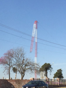
Crumpled KOMA radio tower in Moore, OK
Of the three ex-KOMA (now KOKC) radio towers, this was the only one left standing, and bent over at that.
We entered some data points in “drive-by” mode; for others, we got out and walked gingerly among roof shingles, shards of glass, and boards with protruding nails. An active hum emanated from the entire damage zone. Chainsaws growled, generators purred, and helicopters circled overhead. News crews, police, and city workers were everywhere. Vans filled with ServeMoore volunteers (many of them teenagers, released from class by Moore Public Schools) went from house to house, offering cleanup help. A cherry-red Coca-Cola delivery truck cruised up and down the streets, the driver handing out bottled water. We overheard the neighborhood mail carrier telling the resident of an “orange X” house that she could apply for a free PO box to use until her house was repaired. She later told a reporter that she had “had it” with Moore after suffering tornado damage three times; she would be moving away soon for good.

We documented a shed blown onto its side, a section of roofing lofted two or three blocks (recognizable from the shingle color), damage to the three ex-KOMA radio towers (two fell down, the one left standing folded 1/3 of the way down at its guy point). Even as we went about our duties, we were aware that the residents were grappling with an unexpected and upsetting interruption in their lives. As a home owner, I empathized with the loss of houses and the scattering of neighbors. After almost two decades with the NWS, Doug is well-practiced in performing damage surveys, and he asked his questions with sensitivity. “Were you here when this happened? Did you have enough warning? Was anyone hurt? We’re glad you’re okay.”

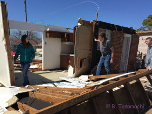
Checking the damage
Tiffany Meyer (left) and Doug Speheger examine the bottom of a collapsed wall in a home near NW 2nd & Arnold Sts in Moore.
We found two particularly intense damage examples that might have qualified as EF2 or greater damage but for some mitigating factor. In one case, a home’s roof had been lifted off, but the failure point was evident. A carport, bolted to the roofline, had been lifted from the driveway by the storm’s winds and peeled off the roof as it blew away. In another, the exterior walls of a home had all collapsed, leaving the interior walls standing like an oversized wine bottle divider. That type of damage might have merited an EF3 rating, but closer examination revealed that the anchor bolts were spaced 8-10 feet apart and only driven about 2 in into the concrete walls. In both cases, the rating stayed at EF1.

It was difficult to differentiate the wind and tornado damage in some areas. For the most part, the winds had moved debris from west to east. We found a few small zones (about half a block in size) where the damage was relatively intense, and clearly convergent. My impression was that we were dealing with a wide swath of mostly straight-line wind damage, with a few small tornadic spinups lasting only a few seconds. A few structures would need to be examined in greater detail.

Compiling the damage survey info in the NWS-Norman WFO
Reconvening with Rick Smith (left) in the WFO, it was decided to announce the finding of EF1 damage and continued investigation.
We returned to Norman around 3 p.m. along with one of the two other survey teams, and related our impressions to Rick Smith and the rest of the office. Based on our report, Rick sent out the following tweets “in time for the four-o’clock news”:

Thanks again to the NWS office in Norman for letting me help make the news!

Edit: Thanks to Doug Speheger for correcting the my interpretation of the “orange X” markings.

Update, 3/30/2015: After some spot-checking of a few structures and a follow-up meeting on 30 March 2015, it was decided to upgrade the house at 2nd & Arnold, as well as a few others, to EF2. NWS-Norman released this damage contour map that afternoon:


Note that this map is still preliminary and could change further!

Update, 4/3/2015: Jim LaDue, another damage survey participant with much more experience than I, conveys his detailed thoughts on this event here.

A novel worth chasing

Looking for a convective literary morsel to test out that new e-reader you got for Christma-solsti-festi-kwanz-ukah? Here’s a suggestion: Supercell by H. W. “Buzz” Bernard.

You need only read the capsule summary to know that it ain’t great literature. It’s a thriller, and it doesn’t purport to be anything more.

What impressed me about this book was how much it got right about chasing. The torment of being torn between two equally favorable (and mutually exclusive) chase targets. Second-guessing yourself when you see other chasers streaming toward the target you rejected. The wisecracking, know-it-all ride-along who regards meteorology as little more than charlatanism, and who relishes rubbing it in your face when you get it wrong. The slow-rolling Christmas tree of modern chaser convergence. The frustrating ennui of the down days. The best setup tantalizing you from the progs, one day after the end of chase-cation. The descriptions of the interplay between different entities pertinent to storm chasing (NWS, SPC, the media, and various different flavors of storm chasers) is more or less correct. The author clearly did his homework, and he acknowledges contributions from some well-known chasers and meteorologists at the end of the book.

I can’t say I was very impressed with the characters, who are mostly cut whole from cultural stereotypes. But, I still enjoyed this read. If you’re suffering from SDS, Supercell might just be the shot in the arm you need to get you to next chase season.

SLS in Madtown

In early November, I flew back to Madison, Wisconsin for the 27th AMS Conference on Severe Local Storms (or “SLS”, as we call it). For those who don’t know, I got my B.S. in Atmospheric and Oceanic Science from UW-Madison. It’s been more than a decade since I packed up my research intern cubicle at SSEC, and I was excited to get back. Experiencing Madison from a high-star hotel within a block of the Wisconsin state capitol dome and State Street was quite a different experience from being stacked, cordwood-style, with other undergraduate students in Chadbourne Hall.

I was much more involved in this conference than I have been in previous ones. This was the first SLS conference on whose program committee I served. That meant I got to review nearly 50 abstracts, helping stratify them into oral and poster slots, and had input on the daily schedule. In addition to our professional contributions, my husband and I also coordinated the informal (and infamous) Video Night for the third time. The conference co-chairs elected to forgo a formal banquet in favor of a come-and-go icebreaker with heavy appetizers, a practice that I favor continuing, because it allows attendees to interact with more than seven people at a round table over the course of the evening.

Contentwise, this SLS conference program was as good as ever. A couple of the highlights:

A note to nonmeteorologists who are interested in severe weather research, particularly students considering a career in that area: Browse the conference program. Watch some of the talks.* Read the extended abstracts and examine the posters. A little more than a decade ago, it wasn’t possible for people outside the conference to access the research presented there (unless you could somehow get your hands on a limited-edition preprint volume). Now, almost the entire content of the conference is available online for public perusal. So, take advantage of it! Get a taste of what scientific research really looks like.

* Keep in mind that the talks are often a 12-minute summary of two or more years of research, coding, and mental exertion. Not all details, caveats, and nuances can be included. (That’s what seminars and peer-reviewed manuscripts are for!)

Purple for Pam


Dr. Pam Heinselman needs no endorsements from me, because the quality of her work speaks for itself. Throughout my graduate school career, she was invariably lauded as someone I should emulate. Chuck Doswell called her “a class act.” In addition to being the leader of the Phased Array Meteorological Studies (PAMS) Team and a Presidential Early Career Award winner, she is the public face of the Phased Array Radar program here at NSSL, actively producing educational materials for public consumption and starring in NSSL podcasts and video shorts like this one.

Pam took me under her wing after I got my meteorology shingle from OU in 2011, first as a postdoctoral research scientist (until this September) and now, as a full research scientist. Pam has the pulse of NSSL, and keeps those of us on the PAMS Team up to speed. She also stays abreast of what we are working on, and comes to every meeting prepared to pick up right where we left off. When I send her draft writing, she gently suggests changes in a way that made me feel empowered, not stupid. She’s also given me her full and unwavering support during my transition to motherhood. I’m honored to call her my friend as well as my supervisor.

Purple for Pam
Purple for Pam at SLS
Pam went public a couple of weeks ago with the news that she is suffering from non-Hodgkin’s lymphoma. She posted on Facebook that her first chemo port was purple, which prompted a number of us to wear purple clothes, scarves, and other royal attire to show our moral support. Pam has had a great attitude about her illness and her chances for beating it. Here’s my #purpleforpam pic, taken while I was at the 27th Severe Local Storms conference in Madison, WI last week. Yes, I know I often break out the purple suit for conferences, but this time it has a special significance. I would not be where I am were it not for Pam Heinselman. My warmest hopes are with her as she pursues remission.

A bouquet of chase history

My friend Blake Naftel recently stopped in Norman to shoot a plethora of interviews for his upcoming film, Storm Chasing: The Anthology. In the decade-and-change that I’ve known Blake, this carrot-topped Michigander unfailingly talked up a film that he dreamed of making someday. In it, he would combine the mountains of VHS and DVD storm footage he had fanatically accumulated since childhood with one-on-one interviews with the individuals who created “storm chasing culture.” The film would cover half a century, from the days before the Eisenhower Interstate Highway System, to the bristling, flashing parade of chasers that seems to materialize under every supercell east of the Rockies today.

Between interviews with old school and new school personalities throughout Norman, Blake stopped by to interview me and my husband. (I guess you could consider us “middle school” or “Twister generation” chasers – although our interest in storm chasing predated Twister by nearly a decade. But I digress.) In the interest of full disclosure, I “kicked in” a little money to Blake’s project back in July, when he publicly crowd-sourced the funding. I’d like to think that my contribution has nothing to do with my being selected to interview alongside the likes of Lou Wicker, Chuck Doswell, and Howie Bluestein, even though my chase catalog isn’t nearly as extensive as either of theirs.

During my two hours in front of Blake’s lights and lens, we focused how storm chasing has changed in the decade-plus that I actively chased. We talked about the growing crowds, the rise of mobile internet, the decline of the nowcaster, the impact of the film Twister and various televised depictions of storm chasers, and changes in storm science, among other things. I speculated on why so many storm chasers hail from Minnesota. (IMHO, it’s because Minnesota experiences all four seasons in their mercurial splendor. Weatherwisdom is simply in our blood.)

Both interviewer and interviewee were rather sleep-deprived, and at one point we both burst out laughing because the dullness of a Q-and-A exchange made it painfully obvious. When I was finished core-dumping my story, I swapped the lavalier mic for my rambuctious 15-month-old son, and Dan took his turn in front of the camera. While Dan spun his own tales, I kept Danny from absconding with Blake’s tapes and equipment. A celebratory pint of dunkelweizen at Das Boot Camp capped off our afternoon. Blake later gave us a shout-out on his project blog.

I look forward to seeing the film Blake will create, which is slated for completion about a year from now. I can’t even imagine the magnitude of the task he has in front of him. To me, it sounds like a Ph.D.-level project – sifting through days of footage, cataloging, transcribing, categorizing, matching spoken narrative with archival footage, and ultimately weaving all the material into a “matrix of stories” (as he put it). But, at the same time, I’m certain that he has the skills and maturity to pull it off. In any event, the hours of interviews he has filmed thus far constitute a treasure trove for future historians interested in our once-obscure and esoteric pursuit. The original definition of the word “anthology” was “a gathering of flowers,” and Blake has gathered quite an immense bouquet.

I’m not dead

Yes, I’m still here. As I alluded to in my last post, I became a mom partway through 2013, and that effectively devoured all of what I once considered “my free time,” including that which I used to devote to blogging. I’ve enjoyed watching my son grow from a tiny bundle of reflexes in the crook of my arm, into an chatty, inquisitive toddler who stuffs fistfuls of spaghetti into his mouth, forcefully demands more graham crackers, and rearranges objects around the house without consulting us. (Case in point, my husband’s glasses. We haven’t seen them in a month! They probably went out in the garbage.) It’s been grueling, and sometimes maddening, but motherhood nourishes my spirit like nothing I’ve ever known.

I’ve been reasonably successful at integrating motherhood and my science career. Perhaps I will write more about that topic in the future, when I have a longer view.

Why so quiet? The Oklahoman atmospheric offerings of 2014 were slim to none, and I was on a short tether because, well, baby. My husband went on a couple of panhandle chases, and may have glimpsed a tornado near Larned, Kansas, back in June. I operated KOUN all of once this year with my son babbling happily in his portable playpen beside me. But 2014 has been the first year since 2001 that I actually did not chase at all. Quite frankly, if I had to take a year off, this year would be a good choice.

An update on me: I’m wrapping up a two-year postdoc stint at NSSL, looking at storm mergers and tornadogenesis. I’m about to submit a paper about the 24 May 2011 El Reno tornadic storm, and hope to be able to share more from it soon. (I’ve been dropping some hints on my Twitter feed.) I’ll be starting as a research scientist at CIMMS at the end of September, collaborating intensely with NSSL. I’m pumped! Working with NSSL has always been one of my primary career goals.

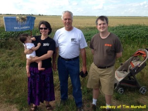
For now, I’ll leave you with this photo Tim Marshall shared of us at the TWISTEX memorial back on 31 May 2014. It was a nice remembrance event. Some kind individuals even provided water and pizza to those who came.

Us and Tim
Checking in with Tim Marshall at the TWISTEX anniversary remembrance.

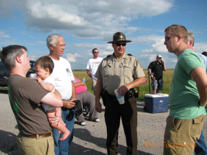
I met Deputy Doug Gerten, the first responder to the tragedy, who’s spearheading an effort to have a permanent roadside memorial erected.
Deputy Doug Gerten (Center)
Canadian County Sheriff Deputy Doug Gerten (center), who found the white Chevy Cobalt.

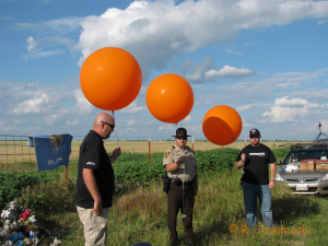
I think we were the only ones at the gathering with an infant in arms. I called him “the littlest witness to the El Reno tornado.” At the end, we watched the release of three orange balloons representing the departing spirits of our friends.
Preparing for the balloon release.

2014-05-31 TWISTEX Memorial 022

2013-05-31: El Reno, OK tornado

This chase log is long overdue. I tried over and over again to write it without the gravitas of the outcome saturating the prose. I’ve decided to stop worrying, post what I drafted, and let the chips fall where they may. It took me a long time to process what happened, but I figure a year later is as good a time as any to publicize my memories, which are not getting any fresher. I also wanted to make my experience known for data collection efforts such as the El Reno Survey Project.

Storm chasing is perceived as an edgy activity because it involves getting close to forces that exceed human scales. I am not an adrenaline junkie; I do not chase for want of fear. As I’ve articulated previously, I chase because I enjoy nature’s majesty and spectacle. We often pay lip service to the risks involved in storm chasing without complete comprehension of what they really entail: mutilation, death, destruction of treasure. This chase was my only one in which I was actually afraid of being overtaken and possibly killed by a tornado. I’m convinced that our escape unscathed from the claws of a murderous, multi-vortex EF-5 resulted from our relatively conservative chase strategy, a dash of luck, and my conscious choice to forgo even a glimpse of the tornado for several minutes as I ferried myself and my passengers to safety. You won’t find too much bravado in my story; we fled the instant we sensed something was afoul. I’m simply grateful that we didn’t add to the casualty count.

In the morning, while perusing the high-res guidance, I noted similarity between the density and pattern of forecast updraft helicity tracks (among other things) and those from 20 May 2013 (the date of the Moore tornado). Dan D. and I both remarked that we had a bad feeling about this day, but since it was likely to be a local chase and the last of our season, we didn’t want to pass it up. Dan D., Youngsun J., Jing C., and I left the NWC parking lot around 4 p.m. and headed west toward Tuttle on OK-37.

We stopped on U.S. Hwy. 81 between Union City and El Reno, where we saw a low-contrast wall cloud near Calumet slowly being squeezed to death between two merging HP storms. Based on the visual presentation, we thought there was a high likelihood that the storms would merge destructively and gust out, or that the HP storms would hide any tornadoes in rain. We decided to venture closer the wall cloud, in hope of catching a glimpse of a tornado before it became a rain-wrapped mess. We drove west on Reno Rd., stopping to observe an outflow surge just west of Heaston Church. A new circulation did appear – a gray barrel set against the emerald green of the HP core. That circulation quickly tightened into a mesocyclone and translated quickly toward the east. I ferried our passengers east with it, until my husband cried out, “Tornado!” I glanced over my left shoulder and saw a white cone dangling from the meso, scraping across the fields about two miles to our north.

Frame grab of the El Reno, OK tornado
This is a frame grab of my only video of the 31 May 2013 El Reno, OK tornado, shot from my dash cam just before we fled east. The white cone in the foreground is a sub-vortex of the gigantic El Reno tornado.
A few minutes later, I backed into a driveway halfway between Fort Reno Rd. and Brandley Rd., facing north. By then, white funnels carouseled around the tornado less than a mile to our northwest. We figured we would have a perfect view as it passed by us to the north. My passengers bailed out and began to shoot video and photos. I monkeyed for a moment with my dash cam, trying to aim it at the tornado, before jumping out to get my tripod and HD camcorder out of the hatch.

Then I hesitated. Something was wrong. The tornado wasn’t moving from left to right – it was moving from right to left, and getting bigger. My husband came to this sinking realization the same moment I did, and announced, “It’s coming toward us! We gotta go!” I shouted, “Back in the car, now!” Youngsun and Jing didn’t hesitate for an instant; everyone was back in their seats within five seconds. I shot out of the driveway and gunned it east. My husband instructed me to turn south at the first available opportunity, emphasizing, “We’re in trouble!”


Vehicles were scattering to the east and south like a flock of startled quail. As I turned south onto Brandley Rd., frustrated by the poky vehicles in front of me, a sobering thought entered my mind. I wasn’t carrying three passengers in my car, I was carrying four. (I was seven months pregnant at the time.*) As if to drive the point home, a Braxton-Hicks contraction chose that moment to give me an eye-popping internal squeeze. I made a conscious decision not to look back over my left shoulder at the tornado, despite the rising alarm in my husband’s voice as he shouted, “Robin, it’s right behind us! GO!!!” I tuned out everything else, and focused my consciousness like a laser beam on the road in front of us. I had to keep my head, and keep the car on the road. We would do no good getting into a rear-end collision or sliding into a ditch in these circumstances.

Inhale, exhale, drive. I wove around a vehicle parked in the right lane, containing two unrestrained dogs. As I passed, a woman looked at me from the drivers’ seat with eyes as big as teacup saucers. My huband rolled down his window and screamed at her, “You’re in the path!” She gaped back at us as though shell-shocked.

Inhale, exhale, drive. The chasers driving south on Brandley Rd. steadied out to about 45 mph. To my passengers, this was excruciatingly slow. I was aware they were shouting at me to drive faster, but I concentrated on maintaining my distance from the vehicle in front of me.

Inhale, exhale, drive. Every window and door seal whistled, and I felt my ears start to pop. The pickup in front of me began to fishtail. I grimaced, preparing to watch – and then dodge – a wreck. Fortunately, the driver pulled out of his or her slide and straightened out.

Inhale, exhale, drive. Brandley Rd. terminated with a turn to the east at SW 59th St, near a farm house with a lengthy driveway. As I rounded the corner, a woman came dashing down the driveway toward the chaser train, waving her arms frantically, a dog racing ahead of her. Dozens of headlights glared from my rear view mirror; I judged that I could not stop without causing a chain-reaction pileup. I would have to run over the dog to avoid it. I sucked in a breath, fully expecting the meaty impact of the dog’s body against my front bumper. Fortunately, the dog pulled up short. To this day, I do not know what that woman was doing. Looking for information? Trying to catch a ride?

Inhale, exhale, drive. At some point we jogged south one more mile to OK-152 (my husband has the GPS log) and entered Union City from the west, where sirens saturated our hearing with their discordant wail. I began to loosen my grip on the wheel as it became apparent that the tornado had lifted north. We came to the four-way stop at the intersection with Hwy. 81. Despite the disaster unfolding just to the north, cars were obeying the law, coming to complete stops, and waiting their turn before proceeding. As I crossed Hwy. 81, I could see a line of headlights stretching north to the horizon. I do not recall observing any contraflow at that intersection, but then again, I wasn’t looking for it.
My husband’s video:


We could see the dark barrel of the mesocyclone now well away to the north, past I-40. I began to relax a little, and we resumed chase mode. We followed OK-152 as far as Mustang, where we decided to call off the chase after seeing that the hook of the storm was entering the Oklahoma City metro.

We spent about an hour woolgathering in a gas station parking lot, figuring out what to do next. We judged that going north to I-40 was not a good idea, because the tornado had clearly crossed it, and we expected it to be closed and jammed with cars.

In our hasty departure from the driveway earlier, my husband Dan misplaced his iPhone. The chase ended, we decided to go back and get it. As we backtracked west on Reno Rd., we made a couple detours around flooding and downed power lines that crossed the road. As we passed one damaged home, I smelled gas. Just west of Brandley Rd., where we had turned south earlier, a 5-ft diameter tree had toppled over and was completely blocking Reno Rd. I had sobering vision of the tornado tossing that barrier in front of our car, trapping us and preventing our escape to the east. We submitted a storm damage report on SpotterNet and circumvented it to the north. A house under construction, which we had passed earlier, was battered by debris, and its Tyvek wrap flapped heavily in the rain.

When we located the place where we had stopped to watch the multiple vortices, my husband hopped out in the cold rain to hunt for his phone. We had already heard reports on commercial radio of injuries and deaths along I-40, and images of the storm were already flashing on the national news. My husband and I sorely wanted to post an update to social media so that our friends and family would know that we were not among the casualties. As Dan searched outside our Prius V in the pouring rain, I suddenly heard the familiar iPhone ring tone. I scrambled down to the floor and discovered his phone hiding beneath the passenger seat, the name “Dad” glowing on the screen. My husband returned to the car, soaked to the bone, and managed to call his dad back.

Civilization reacquired, Dan posted the update, and we decided to head home. Reports of traffic gridlock in Oklahoma City caused us to take a rather circuitous return route via Hinton, Anadarko, and Chickasha. We pulled back into the NWC parking lot well after dark, encountering Jeff Snyder poring over screenshots of freshly-acquired RaXPol data.

Later that night, as we prepared for bed, Dan got a call from our friend Rebekah Labar. She was chase-cationing in Oklahoma after a successful two-year stint in the Kwajalein Atoll, and was finding lodging very hard to come by in the aftermath of the storms. We put her and her chase partner up for the night in our humble home, and traded stories about the day’s events into the wee hours of 1 June.

In retrospect, I saw some bizarre behavior near the El Reno tornado that I have never seen previously. My impression – which I emphasize that I cannot quantify – is that the storm chasers fleeing the El Reno tornado were relatively orderly and law-abiding, whereas local residents fleeing the tornado were acting more out of panic. I inferred that certain vehicles were local because the drivers carried along dogs and young children, companions storm chasers don’t usually carry. At least one vehicle contained unrestrained children standing up in the back seat, as if the parents had put the children in the car in great haste. I did not find out until later that a certain television meteorologist had advised on air for EL Reno residents to flee south, which explains the gridlock we observed along U.S. Hwy. 81. In light of that revelation, the woman running from her house and trying to flag down chasers makes a bit more sense. Was she trying to flag down a chaser and hitch a ride out of the area? I will probably never know. The caravan of chasers escaping south and then east along OK-152 drove single-file, at exactly the same speed, 45 mph. We all seemed to recognize that we had to form a relatively slow-moving “train”, or else we might cause a chain-reaction pileup on a gravel road with a tornado bearing down, a river to our south, and no alternate escape route.

Subsequent analyses of the events by Skip Talbot and Gabe Garfield (among others) lead me to believe that the El Reno tornado may have “licked” the back end of our vehicle with an inflow jet as we fled south along Brandley Rd.. I distinctly remember a “whistle” as a strong, obtuse gust of wind penetrated every seal in our car, and I experienced a half-popping sensation in my eardrums. Although I did not see it on account of my deliberate tunnel vision, my husband says he observed rapid formation of condensation in the field immediately behind us. Our default escape direction was east and south. Had we known a priori the path of the storm, we might have instead headed west to escape the tornado’s southeastward swoop.

Neither our encounter with the El Reno tornado, nor the highly-publicized deaths that it caused among chaser ranks, have diminished my enthusiasm for storms, tornadoes, or storm chasing. The fact that I have not gone chasing since then is due to both meteorological and personal factors. I intend to continue chasing storms, give rain-wrapped tornadoes a wider berth than their naked brethren, and always keep my head on a swivel.

* In July, I gave birth to a healthy baby boy, apparently none the worse for wear after his in utero close encounter with the El Reno tornado. And that, dear readers, explains the relative dearth of postings since then!

If it looks like a tornado…

I have a new paper in the November issue of Monthly Weather Review entitled, “Near-Surface Vortex Structure in a Tornado and in a Sub-Tornado-Strength Convective-Storm Vortex Observed by a Mobile, W-Band Radar during VORTEX2,” written the help of six patient co-authors and three reviewers. This paper addresses the question, “If it looks like a tornado, lasts as long as a tornado, and behaves like a tornado, but only on radar, is it still a tornado?”

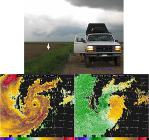
We examined two cases from VORTEX2. In the first (25 May 2010 near Tribune, Kansas), both humans and radars observed a tornado under the hook echo of a supercell. Here is a photo of the Tribune tornado, along with some the W-band data Krzysztof Orzel (UMass) and I collected:

Top: W-band radar truck with Tribune tornado, and data collected.
(top) The UMass W-band radar collects data in the 25 May 2010 Tribune tornado. Krzysztof Orzel (UMass engineer) can be seen next to the truck. (bottom) W-band reflectivity (left) and Doppler velocity (right) in the intensifying Tribune tornado.

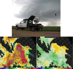
In the second (26 May 2010 near Prospect Valley, Colorado), the radars observed a feature beneath the hook echo of another supercell that looked similar to the tornado seen the previous day, none of the hundreds of storm chasers in the area, including about 100 VORTEX2 participants (some of whom can be counted among the most experienced storm chasers in the world!), reported a tornado or even a funnel cloud. (The Prospect Valley storm produced tornadoes earlier in the afternoon near DIA, but none during VORTEX2 operations.) Indeed, I didn’t even know the vortex was there until the data were post-processed, because it was too small to see on our in-cab display. Closer examination revealed seven of these tiny vortices spinning up in tornado-family-like fashion on the tip of the hook. The one pictured below (#5) was the strongest and longest-lived.
Top: W-band radar truck under Colorado supercell. Bottom: W-band radar data collected in a vortex near the tip of the hook.
(top) The UMass W-band radar collects data beneath the hook echo of the Prospect Valley storm. The black arrow indicates a small cloud base lowering that persisted for more than 30 minutes. (bottom) Radar data collected in the hook echo, showing a vortex with a weak-echo hole that lasted 8 min.

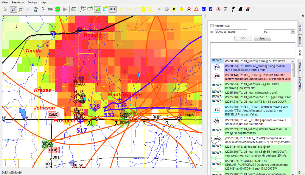
Here’s a screenshot from our in-cab Situation Awareness for Severe Storm Intercept (SASSI) display around the time the above data were collected, showing participants reporting a “small circulation” and “rising motion”. But, no one says the T-word.

SASSI screen grab from Prospect Valley
SASSI screen grab from 2240 UTC on 26 May 2010, showing VORTEX2 vehicles deployed under the Prospect Valley storm. Orange circles are dual-Doppler lobes drawn by the radar coordinator, and the purple cone denotes where the field coordinators believed the circulation would go. “UMW” is the W-band radar.

The radar presentations look similar, no? Those of us who use mobile radar data need “tornado threshold” criteria in order to determine objectively such parameters as tornado start and end times. While there is no universally accepted Doppler velocity threshold for tornadoes, the Alexander and Wurman (2008) criterion (40 m/s across <= 2 km diameter, and persisting for at least two consecutive scans) is used in a number of studies. Both the 25 May and 26 May vortices met this criterion and lasted about 8 minutes, but had it not been for radar observations, we might not have known a vortex was present on 26 May.* We appear to have caught a vortex that just barely tickled the lower end of the tornado spectrum. The surface dew point depressions were much higher - about 12 oC – than on the previous day (8 oC). We speculate that just a little additional moisture would have made this vortex visible and changed the designation of the 26 May case from non-tornadic to tornadic in the VORTEX2 logs.

One might ask, “Who cares? The Prospect Valley vortex damaged nothing and injured no one.” As a scientist, I care. Documenting these types of events with high-quality observations demonstrates that the boundary between tornadic and non-tornadic vortices is fuzzy, and that human and radar detection of tornado occurrence may not always be consistent. Since this article appeared online last week, I’ve gotten a number of e-mails from other scientists who have made similar observations of weak vortices under supercells, but who weren’t sure how to categorize them. We didn’t want to make a new category of vortex for this type of event – there are already enough animals in the zoo*,** – but in this paper we use the clunky term “sub-tornado-strength, convective-storm vortex (SCV)” to describe the Prospect Valley not-quite-tornado.

* Dr. Chuck Doswell documents a similar case using a photograph from Dr. Bill Gallus in his essay, “What is a tornado?” Incidentally, that tornado also occurred in Colorado. The Prospect Valley vortex would not meet Chuck’s tornado definition because it caused no damage.
** CSWR documents a number of these in a recent paper in Weather and Forecasting, including what they call “marginal tornadoes.”